List of police stations in the West Midlands
Most police stations in the West Midlands county of England are now operated by the West Midlands Police, created on 1 April 1974, but many were built for its predecessors, and some of those closed before its creation. A number of the stations are listed buildings and others are locally listed by the relevant local authority. A few are operated by the British Transport Police.
This list also includes administrative buildings which do not have facilities for the visiting public.
Birmingham
Prior to 1974, the majority of police stations in the city were operated by Birmingham City Police. However, as Birmingham's borders expanded over the twentieth century, it absorbed neighbouring territory from Staffordshire and Worcestershire, incorporating the existing local police stations and personnel into the city's infrastructure before all forces were unified under West Midlands Police.
Active stations
| Name | Location | Completed | Geo-coordinates | Notes | Designation | Image | Ref. |
|---|---|---|---|---|---|---|---|
| Acocks Green police station | 21 Yardley Road, Acocks Green | 1909 | 52°27′02″N 1°49′09″W / 52.4505°N 1.8193°W | Built for Yardley Rural District Council, when Acocks Green was in Worcestershire. Decorated with a "three pears" motif from the Worcestershire coat of arms. The station maybe sold off | Locally listed at 'Grade B'. Nationally, Grade II listed.[1] |  | [2][3] |
| Aston police station | Queen's Road, Aston | 52°30′22″N 1°52′36″W / 52.5061°N 1.8767°W | Firearms Base |  | |||
| Birmingham Central police station & HQ (Lloyd House) | Colmore Circus Queensway, Birmingham City Centre | 1964 | 52°29′02″N 1°53′50″W / 52.48378°N 1.89735°W | Functions as the primary force headquarters for West Midlands Police. Following the permanent closure of the nearby Steelhouse Lane station in early 2017, the building was extensively refurbished to fully accommodate Birmingham Central police station operations. |  | ||
| Bournville police station | Bournville Lane, Bournville | 52°25′46″N 1°56′59″W / 52.429357°N 1.949799°W | Near the Bristol Road South between Selly Oak and Northfield |  | |||
| Digbeth police station | High Street, Digbeth | 52°28′35″N 1°53′25″W / 52.4764°N 1.8904°W | Built by the Birmingham firm T. Elvins and Sons. The public contact office was closed for 10 years from 2015 before reopening in December 2025. | Locally listed at 'Grade A' | 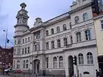 | [5][4][6] | |
| Erdington police station | Sutton New Road and Wilton Road, Erdington | 52°31′34″N 1°50′21″W / 52.5261°N 1.8391°W |  | [7] | |||
| Handsworth West police station | Holyhead Road, Handsworth | 52°30′21″N 1°56′50″W / 52.5059°N 1.9473°W |  Upload Photo | [8] | |||
| King Heath police station | 1 High Street, Kings Heath | 52°26′17″N 1°53′36″W / 52.4381°N 1.8932°W |  | [2] | |||
| Moseley police station | Woodbridge Road, Moseley | 52°26′54″N 1°53′13″W / 52.448468°N 1.886854°W | Officers will relocate from Balsall Heath and Sparkhill, now that Moseley is refurbished |  | [9] | ||
| Nechells police station | Fowler Street, Nechells | 52°29′41″N 1°52′13″W / 52.4946°N 1.8704°W | Upload Photo | [8] | |||
| Newtown police station | 204 Bridge Street West, Newtown | 52°29′37″N 1°53′58″W / 52.4937°N 1.8994°W | Locally listed at 'Grade B' | Upload Photo | [8] | ||
| Quinton police station | 300 Quinton Road, Quinton | 52°27′13″N 1°59′48″W / 52.453719°N 1.996770°W | Closed 2019 - Reopened and refurbished 2024 | Upload Photo | [4] | ||
| Sheldon police station | Sheldon Heath Road, Sheldon | 52°28′14″N 1°47′04″W / 52.470581°N 1.784480°W | It is in Garretts Green |  | |||
| Stechford police station | 338 Station Road, Stechford | 52°28′42″N 1°48′26″W / 52.4784°N 1.8071°W | The future of this station has been secured as of November 2025. |  | [2][10] | ||
| Summerfield police station | Icknield Port Road, Summerfield | 52°29′10″N 1°56′12″W / 52.486124°N 1.936663°W | The station moved from its old building on Dudley Road, near Summerfield Park | Upload Photo | |||
| Sutton Coldfield police station | Lichfield Road, Sutton Coldfield | 52°34′05″N 1°49′25″W / 52.5680°N 1.8237°W | A new police station opened in July 2025 when service transferred to another part of the existing site. |  | [7][4][6] | ||
| West Midlands Police - Learning & Development Centre | Pershore Road, Edgbaston | 52°27′15″N 1°54′26″W / 52.454093°N 1.907280°W | Also known as Tally Ho Police Training |  |
Closed or demolished stations
| Name | Location | Completed | Geo-coordinates | Notes | Designation | Image | Ref. |
|---|---|---|---|---|---|---|---|
| Balsall Heath police station | Edward Road, Balsall Heath | 1869 | 52°27′25″N 1°53′18″W / 52.457076°N 1.888265°W | Built originally for the Worcestershire Quarter Sessions Police Committee before boundary changes. Decommissioned and closed as an active asset, with all local neighbourhood teams completely relocated to the refurbished Moseley hub. |  | [4][9] | |
| Billesley police station | Yardley Wood Road, Billesley | 52°25′54″N 1°52′10″W / 52.431548°N 1.869503°W | Demolished in 2024. A housing development called The Canopies was built here from 2025 to 2026. With a pair of cul-de-sacs called Theresa Way and Stewart Close after Theresa Stewart former leader of Birmingham City Council. |  | [11] | ||
| Bordesley Green police station | 282 Bordesley Green | 52°28′39″N 1°51′03″W / 52.477588°N 1.850719°W | This is now Heartland Hostel. The police station closed down by 2010. |  | [12] | ||
| Canterbury Road police station | Canterbury Road, Perry Barr | 1904 | 52°30′45″N 1°54′05″W / 52.5126°N 1.9015°W | Built when the area was still part of Staffordshire, featuring an exterior Staffordshire Knot emblem. It housed specialized police units but had no public front desk. Decommissioned and sold at auction, with planning permission later approved for conversion into 14 residential apartments. | Locally listed at 'Grade A' |  | [13][14] |
| Castle Vale police station | 44 High Street, Castle Vale | 52°31′17″N 1°47′01″W / 52.5215°N 1.7837°W | This former police station was up for auction in October 2016 |  | [7][15] | ||
| Dudley Road police station | Summerfield Park, Summerfield | 52°29′10″N 1°56′16″W / 52.48625°N 1.93771°W | Disused; at risk |  | [16] | ||
| Edgbaston police station | Belgrave Middleway, Edgbaston | 52°27′59″N 1°53′57″W / 52.4663°N 1.8991°W | Permanently closed |  | |||
| Hall Green police station | Robin Hood Lane, Hall Green | 52°25′19″N 1°50′14″W / 52.421855°N 1.837172°W | Following its closure, the building was converted into a succession of restaurants. It originally operated as the Blue Lamp, followed by the China Garden (closed 2022), Paradiso Pizzeria (2023), and In Chi (2024–2026). It reopened as Hojra Restaurant in August 2026. |  | |||
| Handsworth police station | Thornhill Road, Handsworth | 1878 | 52°30′13″N 1°55′42″W / 52.5037°N 1.9284°W | Built at the same time as the nearby library and town hall. Originally in Staffordshire; includes a courthouse. The front counter to the general public in 2016. It permanently closed down by October 2023. | Locally listed at 'Grade B' | Upload Photo | [8][17][4] |
| Harborne police station | Rose Road, Harborne | 52°27′43″N 1°56′54″W / 52.462060°N 1.948436°W | As of 2025, are plans to demolish Harborne Police Station, and build townhouses and apartments here. |  | [4][18] | ||
| Hay Mills police station | Coventry Road, Yardley | 52°27′46″N 1°49′26″W / 52.4627°N 1.8240°W | Now a pub, 'The Old Bill and Bull'. |  | |||
| Jewellery Quarter police station | Golden Square, Warstone Lane, Hockley | 52°29′15″N 1°54′40″W / 52.4876°N 1.9111°W | Located in what is now Golden Square. Closed by 2017. Replaced by the Diamond Factory. |  | [8] | ||
| Kenyon Street police station | Kenyon Street, Hockley | 52°29′15″N 1°54′40″W / 52.4876°N 1.9111°W | Closed 1972; demolished. | Upload Photo | [19] | ||
| Kingstanding police station | Kingstanding Road, Kingstanding | 52°32′44″N 1°53′03″W / 52.54562°N 1.88414°W | Closed in 2019 after being declared surplus to requirements by the force. The commercial building was sold off and subsequent planning applications were submitted to convert the premises into a mixture of four residential flats and a retail takeaway. |  | [7][4] | ||
| Kings Norton police station | High Meadow Road, Kings Norton | 52°24′26″N 1°55′35″W / 52.407293°N 1.926419°W | Was demolished by January 2022. As of 2025 it was replaced by St. Nicholas Lodge from Churchill Living. Flats for the over 60's. |  | [22] | ||
| Ladywood police station | Ladywood Middleway, Ladywood | 52°28′34″N 1°55′30″W / 52.4760°N 1.9251°W | Replaced an earlier station, nearby. Sold to developers in 2024. |  | [23] | ||
| Longbridge police station | Bristol Road South, Northfield | 52°24′17″N 1°58′43″W / 52.404845°N 1.978562°W | The former police station was sold at auction and was converted into offices on the ground floor and apartments above. |  | [24] | ||
| Perry Barr police station | 394 Walsall Road, Perry Barr | 52°31′45″N 1°54′40″W / 52.5293°N 1.9112°W | Sold September 2017 to the Great Barr Muslim Foundation, for conversion to a community centre. |  | [8][25] | ||
| Shard End police station | 161 Packington Avenue, Shard End | 52°29′33″N 1°46′36″W / 52.49258°N 1.77661°W | Decommissioned as a local neighborhood base. While the final property disposal was temporarily back-logged to support teams during the Stechford station refurbishment, a formal housing planning application was filed in February 2026 to build three 5-bedroom homes on the site's car park. |  | [4][26][27] | ||
| Sparkbrook Police Outpost | Stratford Road, Sparkbrook | 52°27′45″N 1°52′31″W / 52.462524°N 1.875377°W | Was at the site from at least 2009 to 2012. Replaced by an estate agent, barber shop and now a 24 hour convenience store. | Upload Photo | |||
| Sparkhill police station | Stratford Road, Sparkhill | 1897 | 52°27′02″N 1°51′53″W / 52.4506°N 1.8646°W | Formerly housed the West Midlands Police Museum (it has been relocated to Steelhouse Lane). Relocated to Moseley to form a hub as Birmingham East. Closed in 2016, sold in 2023 to the Bosnian community. Now a community centre with café, religious and educational training spaces and a caretaker's flat called Bosnia House. | Locally listed at 'Grade B' |  | [8][9][28][29] |
| Steelhouse Lane police station | Steelhouse Lane, Birmingham | 1933 | 52°29′03″N 1°53′36″W / 52.4843°N 1.8934°W | AKA Birmingham Central police station. The cell block is an older, Victorian building. The station closed permanently on Sunday 15 January 2017. |  | [30][31][32] |
Coventry
Prior to 1969, policing in the city was administered by Coventry City Police. In 1969, the city force amalgamated with Warwickshire Constabulary to form the short-lived Warwickshire and Coventry Constabulary. This arrangement lasted until 1974, when Coventry was officially absorbed into the new West Midlands metropolitan county, passing its staff and operational stations over to West Midlands Police.
Active stations
| Name | Location | Completed | Geo-coordinates | Notes | Designation | Image | Ref. |
|---|---|---|---|---|---|---|---|
| Canley police station (Bow Court) | Bow Court, Fletchworth Gate, Canley | 2025 | 52°24′01″N 1°32′37″W / 52.40021°N 1.54352°W | Opened in early 2025 as a modern, 24/7 non-public-facing deployment base for local response teams, replacing the old Fletchamstead Highway facility. | Upload Photo | [33][34] | |
| Coventry Central police station | Little Park Street, Coventry | 52°24′17″N 1°30′30″W / 52.404610°N 1.508298°W | 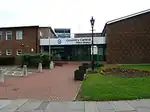 | ||||
| Willenhall police station | Chace Avenue, Willenhall | 52°23′12″N 1°28′19″W / 52.386677°N 1.472071°W | Reopened, after being closed for 10 years, in 2025. |  | [4][6] |
Closed or demolished stations
| Name | Location | Completed | Geo-coordinates | Notes | Designation | Image | Ref. |
|---|---|---|---|---|---|---|---|
| Canley police station | Fletchamstead Highway, Canley | 52°23′36″N 1°33′06″W / 52.393432°N 1.551631°W | Permanently closed by West Midlands Police after being deemed no longer fit for purpose. A prior layout listed it on Sir Henry Parkes Road. A demolition plan was officially submitted in October 2025 ahead of redevelopment. | Upload Photo | [34] | ||
| Foleshill police station | Stoney Stanton Road, Foleshill | 52°25′33″N 1°29′41″W / 52.425925°N 1.494657°W | Public front counter was shut in February 2015. The entire base was later closed completely and decommissioned as part of West Midlands Police cost-cutting measures. | Upload Photo | [35][36]
|
Dudley
Dudley's stations were originally operated by Dudley Borough Police, then from 1 April 1966 until 31 March 1974, by West Midlands Constabulary. Following the local government reorganisations of 1974, all local stations and personnel were absorbed into the modern West Midlands Police.
Active stations
| Name | Location | Completed | Geo-coordinates | Notes | Designation | Image | Ref. |
|---|---|---|---|---|---|---|---|
| Dudley Police Station (2025 - present) | Castlegate Way, Dudley | 2025 | 52°30′52″N 2°04′23″W / 52.51432°N 2.07315°W | Opened from 17th November 2025 on the site of a former insurance call centre. | Upload Photo | [37][6] |
Closed or demolished stations
| Name | Location | Completed | Geo-coordinates | Notes | Designation | Image | Ref. |
|---|---|---|---|---|---|---|---|
| Brierley Hill Police Station | Bank Street, Brierley Hill | 52°29′02″N 2°07′21″W / 52.483795°N 2.122546°W | Part of Civic Hall complex, Closing end of 2025 |  | |||
| Dudley Police Station (closed by 2019) | New Street, Dudley | 52°30′43″N 2°04′59″W / 52.511855°N 2.082954°W | Now closed and sold (between 2017 and 2019). |  | |||
| Historic Netherton police station | Northfield Road, Netherton | 52°29′25″N 2°04′59″W / 52.490193°N 2.083161°W | An older, historic police station building located adjacent to the Netherton Arts Centre. The premises were later decommissioned from police use and subsequently converted into a café. |  |
| ||
| Netherton police station | Church Road, Netherton | 52°29′29″N 2°05′02″W / 52.491410°N 2.083838°W | Permanently closed on 31 January 2016 as part of a cost-saving restructuring strategy by West Midlands Police. | Upload Photo | [38] | ||
| Sedgley police station | Vicar Street, Sedgley | 1864 | 52°32′25″N 2°07′25″W / 52.540172°N 2.123697°W | Originally built as a village workhouse in 1734 and converted into a police station and court in the 1860s. Operational policing ceased in October 2020 when staff relocated to Dudley Fire Station. The landmark building has since been converted into a nine-apartment residential complex named All Saints View, retaining its original cell doors and courtroom features. |  | [39][40]
| |
| Stourbridge police station | New Road, Stourbridge | 1885 | 52°27′17″N 2°08′42″W / 52.454715°N 2.145071°W | Built as the County Police station, it replaced an earlier court and jail on the site. Now closed and being developed into luxury apartments. |  |
Sandwell
Before 1974, police stations in Sandwell were operated by Staffordshire Police (with some areas falling under the jurisdiction of West Midlands Constabulary following the 1966 Black Country boundary changes). In 1974, the county boroughs of Warley and West Bromwich merged to form Sandwell, with policing control transferring entirely to West Midlands Police.
Active stations
| Name | Location | Completed | Geo-coordinates | Notes | Designation | Image | Ref. |
|---|---|---|---|---|---|---|---|
| Smethwick police station | Piddock Road, Smethwick | 1907 | 52°29′38″N 1°58′02″W / 52.493790°N 1.967288°W | Also known as South Sandwell Police Station. Saved from total closure after a plan was approved to split the site; the former courthouse section was sold for residential development, while the station building was retained as an active, non-public operational base for neighbourhood officers. | Upload Photo | [41][42]
| |
| Tipton police station | Lower Church Lane, Tipton | 52°31′33″N 2°04′24″W / 52.5258°N 2.0734°W | Saved from scheduled closure following a successful community campaign. Reopened as a 999 emergency response hub hosting local neighbourhood officers. | Upload Photo | [43]
| ||
| West Bromwich Police Station | Oak Road and Price Street, West Bromwich | 2011 | 52°31′02″N 1°59′54″W / 52.517262°N 1.998399°W |  |
Closed or demolished stations
| Name | Location | Completed | Geo-coordinates | Notes | Designation | Image | Ref. |
|---|---|---|---|---|---|---|---|
| Court of Requests | Church Street, Oldbury | 1816 | 52°30′17″N 2°00′57″W / 52.504693°N 2.015808°W | former police station & court; now J D Wetherspoon pub, "Court of Requests" | Grade II listed |  | [44] |
| Oldbury police station | Stone Street (off Oldbury Ringway), Oldbury | 52°30′08″N 2°00′45″W / 52.502260°N 2.012451°W | Permanently closed by West Midlands Police. Planning permission was granted by Sandwell Council in May 2026 to convert the vacant building into six residential flats. |  | [45] | ||
| Wednesbury police station | Holyhead Road, Wednesbury | 1977 | 52°33′14″N 2°01′24″W / 52.5539°N 2.0232°W | Permanently closed and decommissioned as part of the West Midlands Police estates consolidation program. | Upload Photo | [46] | |
| Windmill House (Police Training Centre) | 160 Windmill Lane, Smethwick | 1970s | 52°29′24″N 1°57′24″W / 52.49012°N 1.95672°W | Not a public police station, but a West Midlands Police training centre and accommodation hostel. Closed by the force and subsequently subject to a January 2026 planning application for conversion into a 76-bed residential HMO supporting local healthcare staff. |  | [47] |
Solihull
Before the creation of the West Midlands metropolitan county in 1974, the town of Solihull and its surrounding rural districts were part of the historic county of Warwickshire. Policing and local stations in the area—including newer developments like Chelmsley Wood—were originally constructed and operated by Warwickshire Constabulary before being transferred over to West Midlands Police.
Active stations
| Name | Location | Completed | Geo-coordinates | Notes | Designation | Image | Ref. |
|---|---|---|---|---|---|---|---|
| Solihull police station | Homer Road, Solihull | 52°24′44″N 1°46′51″W / 52.4122°N 1.7807°W | May close and be replaced by a contact office. The closure could be halted if civil servants move in. |  | [4][48] | ||
| Chelmsley Wood police station - The Walk-in Centre | Ceolmund Crescent, Chelmsley Wood | 52°28′52″N 1°44′29″W / 52.481018°N 1.741373°W |  |
Closed or demolished stations
| Name | Location | Completed | Geo-coordinates | Notes | Designation | Image | Ref. |
|---|---|---|---|---|---|---|---|
| Shirley police station | Stratford Road, Shirley | 52°24′33″N 1°49′31″W / 52.4093°N 1.8252°W | Closed down in 2015, was for sale in 2017. Demolished in 2018. Replaced by Sir Robert Peel Court. |  | [49][50] |
Walsall
Walsall's stations were originally operated by Walsall Borough Police, then from 1 April 1966 until 31 March 1974, by West Midlands Constabulary. Operation of these buildings passed over to West Midlands Police upon its formation on 1 April 1974.
Active stations
| Name | Location | Completed | Geo-coordinates | Notes | Designation | Image | Ref. |
|---|---|---|---|---|---|---|---|
| Brownhills police station | 25 Chester Road North, Brownhills | 52°38′59″N 1°56′16″W / 52.649771°N 1.937684°W |  | ||||
| Bloxwich police station | 1 Station Street, Bloxwich | 52°36′52″N 2°00′20″W / 52.614536°N 2.005571°W | Upload Photo |
|
Closed or demolished stations
| Name | Location | Completed | Geo-coordinates | Notes | Designation | Image | Ref. |
|---|---|---|---|---|---|---|---|
| Aldridge police station | Anchor Road, Aldridge | 52°36′14″N 1°55′05″W / 52.603790°N 1.918109°W | Ceased operating as a public counter station in 2014. The building was officially sold off in June 2025, with the neighbourhood policing team co-locating to Aldridge Fire Station on Northgate. | Upload Photo | [51][52]
| ||
| Darlaston police station | Crescent Road, Darlaston | 52°34′06″N 2°02′00″W / 52.568219°N 2.033444°W | Sold 2019. Plans to convert to residential flats; retaining frontage.[53] | Grade II listed.[54] |  |
| |
| Walsall police station (from 1866) | Goodall Street, Walsall | 1866 | 52°35′00″N 1°58′43″W / 52.583251°N 1.978722°W | It's now Sofia's Restaurant |  | ||
| Leamore Police Outpost | Stephenson Avenue, Leamore | 52°36′06″N 2°00′27″W / 52.601580°N 2.007542°W | Was next to the BCHA centre. Closed down by 2017. |  | |||
| Walsall police station (until 2016) | Green Lane, Walsall | 52°35′20″N 1°59′12″W / 52.588986°N 1.986687°W | Closed down in 2016 | Upload Photo | |||
| Willenhall police station | John Street, Willenhall | 1939 | 52°35′02″N 2°03′12″W / 52.583853°N 2.053227°W | Closed by 2024. Reopening as of April 2026 as The Old Station House as apartments. |  | [55] |
Wolverhampton
Wolverhampton's stations were originally operated by Wolverhampton Borough Police, then from 1 April 1966 until 31 March 1974, by West Midlands Constabulary. Control of the city's stations and policing infrastructure transferred to West Midlands Police in 1974.
Active stations
| Name | Location | Completed | Geo-coordinates | Notes | Designation | Image | Ref. |
|---|---|---|---|---|---|---|---|
| Low Hill Police Base | 147 Fifth Avenue, Low Hill | 52°36′28″N 2°07′01″W / 52.607859°N 2.117025°W | Upload Photo | ||||
| Tettenhall police station | 30 High Street, Tettenhall | 52°35′51″N 2°10′06″W / 52.597400°N 2.168415°W |  | ||||
| Wednesfield police station | Alfred Squire Road, Wednesfield | 52°35′56″N 2°04′51″W / 52.598884°N 2.080726°W | May close and be sold off |  | [4] | ||
| Wolverhampton Central police station | Metro One Campus, Bilston Street, Wolverhampton | 52°35′04″N 2°07′28″W / 52.584306°N 2.124538°W | As of 2025 the future of this station has been secured and it will be renovated over a 16 month period. |  | [56] |
Closed or demolished stations
| Name | Location | Completed | Geo-coordinates | Notes | Designation | Image | Ref. |
|---|---|---|---|---|---|---|---|
| Bilston police station | Mount Pleasant, Bilston | 52°34′02″N 2°04′26″W / 52.567349°N 2.073991°W | Closed down |  |
References

- ↑ Historic England. "Acocks Green Police Station and former courthouse (Grade II) (1459333)". National Heritage List for England. Retrieved 21 October 2023.
- 1 2 3 "Contact us - Birmingham East". West Midlands Police. Archived from the original on 27 March 2014. Retrieved 27 March 2014.
- ↑ "Local list". Acocks Green History Society: new website. Retrieved 27 March 2014.
- 1 2 3 4 5 6 7 8 9 10 11 12 "MPs vow to fight police station closures after West Midlands Police Commissioner says 24 will go". Birmingham Mail. 16 February 2018. Retrieved 19 February 2018.
- ↑ Chinn, Carl (2000). Brum and Brummies. Brewin Books. p. 87. ISBN 1858581818.
- 1 2 3 4 Corrigan, Billy (7 December 2025). "Digbeth police station's public contact office reopens". West Midlands Police. Retrieved 7 December 2025.
- 1 2 3 4 "Your Local Police - Birmingham North". West Midlands Police. Archived from the original on 31 March 2014. Retrieved 27 March 2014.
- 1 2 3 4 5 6 7 "Your Local Police - Birmingham West and Central". West Midlands Police. Archived from the original on 28 March 2014. Retrieved 27 March 2014.
- 1 2 3 "Moseley police station will be main hub as officers move out of Sparkhill and Balsall Heath". Birmingham Mail. 21 April 2022. Retrieved 24 August 2026.
- ↑ "Future of Stechford police station secured thanks to new investment". West Midlands Police. 17 November 2025. Retrieved 18 November 2025.
- ↑ "The Canopies, Billesley, Birmingham". Wonderful Homes. Retrieved 10 January 2025.
- ↑ "Bordesley Green hostel plan sparks protests". Birmingham Mail. 23 August 2010. Retrieved 26 January 2017.
- ↑ "Disposal of Property Decision (Draft): Canterbury Road". West Midlands Police and Crime Commissioner. Archived from the original on 28 March 2014. Retrieved 27 March 2014.
- ↑ "Plans to turn former Birmingham police station into flats". Business Live. 17 August 2018. Retrieved 24 August 2026.
- ↑ "Fancy a night in the cells? Cop shop goes on the market". Birmingham Mail. 7 October 2016. Retrieved 11 September 2017.
- ↑ Jones, Tamlyn (29 June 2016). "Nine treasured West Midlands buildings at risk of being lost forever". Birmingham Post. Retrieved 10 July 2016.
- ↑ "Thornhill Road Police Station (Formerly Staffordshire Court)". Legacy-WM. Archived from the original on 25 October 2014. Retrieved 27 March 2014.
- ↑ Alexander Brock (1 September 2025). "Plans lodged to demolish former Birmingham police station for new homes". Birmingham Mail. Retrieved 2 September 2025.
- ↑ Haddleton, Marie E; Sergeant Gordon Tracey (24 September 2007). "Kenyon Street Police Station". The Hockley Flyer. Retrieved 26 March 2014.
- ↑ Horritt, Josh (4 April 2023). "Domino's plan for former Birmingham police station". Switch Radio. Retrieved 24 August 2026.
- ↑ "Commercial property agents secure deal for police station to transform into new homes". Greater Birmingham Chambers of Commerce. 24 April 2025. Retrieved 24 August 2026.
- ↑ Perrin, Ben (16 October 2020). "Kings Norton police station to be transformed into luxury retirement homes". Birmingham Mail. Retrieved 23 January 2022.
- ↑ "Meet the men who bought a police station — straight after donating to Labour". Birmingham Dispatch. Birmingham Dispatch. 24 August 2026. Retrieved 24 August 2026.
- ↑ "Planning application submitted for former Longbridge Police Station". B31 Voices. 17 February 2018. Retrieved 17 February 2018.
- ↑ Hussain, Danny (7 September 2017). "Former police station being turned into Muslim community centre". birminghammail. Retrieved 11 September 2017.
- ↑ Byrne, Liam (28 May 2026). "Shard End Police Station Status Update". Instagram / Liam Byrne MP. Retrieved 24 August 2026.
- ↑ "Shard End Community Planning Notice: App 2026/00046/PA". Your Shard End Community Group. 5 February 2026. Retrieved 24 August 2026.
- ↑ Vasta, Anisah (6 January 2023). "Historic police station with more than a century of crime history is up for sale". Retrieved 6 January 2023.
- ↑ "Plans approved to turn former police station into centre for Bosnian refugees". Birmingham Mail. 1 September 2023. Retrieved 3 September 2023.
- ↑ Goer, Matthew (14 August 2007). Steelhouse Lane Conservation Area Character Appraisal (PDF). Birmingham City Council. Archived from the original (PDF) on 24 March 2014. Retrieved 24 March 2014.
- ↑ "Birmingham's Hidden Spaces: What future for Steelhouse Lane's 'mini-prison'?". Birmingham Post. 31 December 2013. Retrieved 24 March 2014.
- ↑ "Steelhouse Lane police station closes for final time". BBC News. 15 January 2017. Retrieved 16 January 2017.
- ↑ "Bow Court Police Station". Google Maps. Retrieved 24 August 2026.
- 1 2 Harrison, Claire (23 October 2025). "Demolition plan revealed for old Canley Police Station as new future emerges". Coventry Telegraph. Retrieved 24 August 2026.
- ↑ "Foleshill police station will be closed to the public from February". Coventry Telegraph. 16 January 2015. Retrieved 24 August 2026.
- ↑ "Top copper surprised by low numbers using Coventry police offices". Coventry Telegraph. 18 November 2014. Retrieved 24 August 2026.
- ↑ Ben Perrin (22 November 2025). "Former insurance call centre converted into new police station and branded 'vital hub'". Birmingham Mail. Retrieved 22 November 2025.
- ↑ "Police station closure is "a big blow" to Netherton". Dudley News. 3 February 2016. Retrieved 24 August 2026.
- ↑ "Auction sale of former Sedgley police station offers best hope for new lease of life". Bond Wolfe Auctions. 26 June 2026. Retrieved 24 August 2026.
- ↑ "Sedgley Police Station now housing, first look inside". Express & Star. 16 July 2025. Retrieved 24 August 2026.
- ↑ "Smethwick's police base saved under new plan to retain part of building". Express & Star. 7 March 2025. Retrieved 24 August 2026.
- ↑ Sheridan, Mike (9 March 2026). "Decision due on Smethwick Police Station affordable flats plan". Place Midlands. Retrieved 24 August 2026.
- ↑ Preece, Ashley (14 July 2023). "U-turn as 24 police officers to move to new base in violence hotspot". Birmingham Mail. Retrieved 24 August 2026.
- ↑ "Oldbury Public Library A Grade II Listed Building in Oldbury, Sandwell". British Listed Buildings. Retrieved 18 March 2017.
- ↑ Barnett, Christian (24 May 2026). "New plans confirmed for former Black Country police station". Birmingham Mail. Retrieved 24 August 2026.
- ↑ "'Disappointment' over Sandwell police station closures". BBC News. 30 November 2021. Retrieved 24 August 2026.
- ↑ "Former police training centre could become HMO". BBC News. 6 January 2026. Retrieved 24 August 2026.
- ↑ "Closure of Solihull police station could be halted if civil servants are given green light to move in". Solihull Observer. Retrieved 25 November 2020.
- ↑ "Shirley Police station set to close". Solihull Observer. Retrieved 6 October 2017.
- ↑ "Sir Robert Peel Court Shirley". Kingslea Homes. Retrieved 25 November 2020.
- ↑ "West Midlands Police Estates Strategy". West Midlands Police and Crime Commissioner. Retrieved 24 August 2026.
- ↑ "Freedom of Information Disclosure: Aldridge Police Station (Ref: 713/26)". West Midlands Police. 15 August 2026. Retrieved 24 August 2026.
- ↑ Thandi, Gurdip (4 December 2020). "Former police station to converted into flats". Birmingham Live. Retrieved 22 October 2023.
- ↑ Historic England. "Former Police Station and attached railings (Grade II) (1480422)". National Heritage List for England. Retrieved 22 October 2023.
- ↑ Dan Stacey (2 April 2026). "Former police station set for new life as modern apartments in Willenhall". Express and Star. Retrieved 7 April 2026.
- ↑ "Major investment in Wolverhampton Police Station". West Midlands Police. 4 October 2025. Retrieved 18 November 2025.