Thompson Glacier
| Thompson Glacier | |
|---|---|
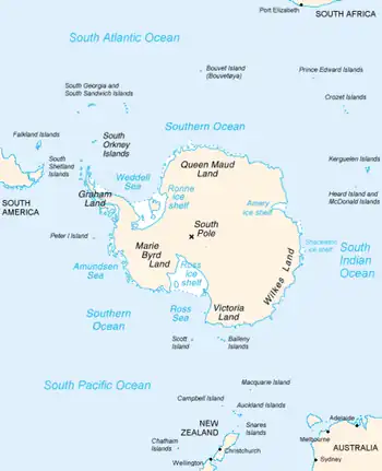 Map of Antarctica, with Wilkes Land slightly to the right | |
  Location within Antarctica | |
| Type | channel |
| Location | Wilkes Land |
| Coordinates | 66°45′00″S 123°39′00″E / 66.75000°S 123.65000°E |
| Thickness | unknown |
| Terminus | Paulding Bay |
| Status | unknown |
Thompson Glacier (66°45′S 123°39′E / 66.750°S 123.650°E) is a channel glacier draining northward to the head of Paulding Bay. Delineated by Gardner Dean Blodgett (1955) from aerial photographs taken by Operation Highjump (1946–47). Named by Advisory Committee on Antarctic Names (US-ACAN) after Egbert Thompson, Midshipman on the sloop Wilkes.
See also
References
 This article incorporates public domain material from "Thompson Glacier". Geographic Names Information System. United States Geological Survey.
- ↑ Cite error: There are
<ref>tags on this page without content in them (see the help page).
<ref group=nb> tags on this page, but the references will not show without a {{reflist|group=nb}} template (see the help page).