Shanghai Municipality (1927–1949)
| 上海市 Shanghai Abbreviated: 滬, 滬市 | |||||||||||||||||
|---|---|---|---|---|---|---|---|---|---|---|---|---|---|---|---|---|---|
| Special municipality of Republic of China | |||||||||||||||||
| 1927–1949 | |||||||||||||||||
 | |||||||||||||||||
| Location of Shanghai Municipality within the Republic of China, 1948 | |||||||||||||||||
| Area | |||||||||||||||||
• 1946 | 617.995 km2 (238.609 sq mi) | ||||||||||||||||
| Population | |||||||||||||||||
• 1948 | 5,448,466 | ||||||||||||||||
| History | |||||||||||||||||
• Reorganised from the planned Songhu Special Municipality, which had been proposed in 1925 to be formed by merging parts of Shanghai County and Baoshan County | 29 March 1927 | ||||||||||||||||
• Reorganised as Shanghai | May 1930 | ||||||||||||||||
| 3 March 1932 | |||||||||||||||||
| 13 August 1937 | |||||||||||||||||
| 15 August 1945 | |||||||||||||||||
• People's Liberation Army captures Shanghai | 27 May 1949 | ||||||||||||||||
| |||||||||||||||||
| Today part of |  China, Shanghai | ||||||||||||||||


Shanghai Municipality (上海市), commonly known as Shanghai (上海, postal romanization: Shanghai;[1] Wade–Giles: Shang-hai[note 1]), abbreviated as "Hu" (沪), was one of the 12 direct-controlled municipalities established by the Republic of China on the Chinese mainland, and at the time was the largest city in the Far East and Asia, as well as China's most important treaty port and industrial centre,[2][3] and was known as the "Paris of the Orient".[4] It was described by the then-chairman of the National Government Chiang Kai-shek as "the focal point of Chinese and foreign attention".[5][2]
In 1927, the Shanghai Special Municipality was established as a direct-controlled municipality.[6] Following the January 28 incident of 1932, China and Japan signed an armistice agreement after negotiations, and Shanghai became a demilitarised zone. During the Battle of Shanghai in 1937, Japanese forces occupied the Chinese-administered areas of Shanghai and parts of the Shanghai International Settlement, and subsequently propped up puppet regimes including the Great Way Municipal Government of Shanghai.
After victory in the Second Sino-Japanese War in 1945, the National Government took over Shanghai, ending the long-established concession system.[7] The Chinese Communist Party reignited fighting in Manchuria, triggering the Second Chinese Civil War. Shanghai's economy was severely damaged by the war, and after the civil war resumed, inflation caused by the fighting led to soaring prices.[8] In 1948, the ROC government's Gold Yuan reform failed, causing Shanghai's economy to collapse further.[9]
In May 1949, the People's Liberation Army launched the Battle of Shanghai;[10] after several days of fierce fighting, it took control of the entire city on 27 May, and the central government relocated part of its assets and personnel to Taiwan. On 28 May, the Shanghai Municipal Government ceased operations, and acting mayor Zhao Zukang transferred power to the CCP-appointed mayor Chen Yi.
History
Early period of direct administration
In 1925, the Beiyang government had already planned to carve out the northern part of Shanghai County and the southern part of Baoshan County to create the Songhu Special Municipality, but this was never realised.[11] On 29 March 1927 (the 16th year of the Republic), the Wuhan National Government established the Shanghai Special Municipality in areas of Shanghai outside the concessions,[6] and established the Provisional Municipal Government of Shanghai Special Municipality to administer it. At the same time, 17 urban and rural areas previously belonging to Shanghai County and Baoshan County under Jiangsu Province were incorporated, giving a total area of 494 square kilometres. Shanghai formally separated from Jiangsu Province's jurisdiction and came under the direct authority of the Executive Yuan. After the April 12 incident, the Provisional Municipal Government of Shanghai Special Municipality effectively ceased operations and was ultimately taken over by the Kuomintang Shanghai Provisional Political Committee.
After the establishment of the National Government of China (hereafter "National Government"), the Shanghai Special Municipality Government was formally constituted on 7 July 1927 in accordance with the Provisional Regulations of the Shanghai Special Municipality.[Note 1] Subsequently, the promulgation of the Organic Law of the Shanghai Special Municipality and the Organic Law of Shanghai Municipality gradually established a two-tier administrative management system at the municipal and district levels.
Because of its proximity to the ROC capital Nanjing and its role as a centre of foreign trade, large numbers of financial institutions—including the four major banks—established their headquarters in Shanghai, further consolidating its status as the national economic and financial centre. As Nanjing was designated the ROC capital, many politicians who had previously gathered in Beiping and Tianjin moved south, and many chose to settle in the Shanghai concessions. Both the concession areas and the Chinese-administered areas of Shanghai developed rapidly during the subsequent Golden Decade of the National Government.
In May 1930, the National Government issued the Organic Law of Shanghai Municipality, reorganising the Shanghai Special Municipality as Shanghai Municipality, and in July of the same year established the Shanghai Municipal Government.
Demilitarisation
After the Mukden incident in 1931 (the 20th year of the Republic), anti-Japanese sentiment ran high among the Chinese public, and Japan announced it would take self-defence measures to protect the interests of Japanese nationals. On 18 January 1932 (the 21st year of the Republic), Japanese monks passing the gate of the Sanyou Industrial Factory on Mayan Road in the Chinese-administered area adjacent to the eastern district (Yangshùpu) of the Shanghai International Settlement were beaten by factory pickets, resulting in one death; this became known as the Japanese monks' incident. Japanese residents retaliated violently, burning down the Sanyou factory, killing Chinese police constables in the concession, and attacking Chinese shops. At 23:30 on 28 January, Japanese naval landing forces advanced westward from North Sichuan Road to occupy the Songhu Railway defence line, where they met fierce resistance from the 19th Route Army at Tiantong'an station. In the early morning of 29 January, Japanese aircraft bombed the Chinese-administered areas of Zhabei; the Commercial Press at 584 Baoshan Road and the Oriental Library (China's largest private library, housing over 300,000 volumes) were both destroyed. Intense military conflict between China and Japan in the Zhabei district of Shanghai lasted over a month; Japan committed a total force of three divisions and 70,000 troops, while Zhang Zhizhong's 5th Army also joined the fighting in Shanghai, and the Nanjing National Government even temporarily relocated to Luoyang to demonstrate its resolve not to capitulate (returning to Nanjing at the end of the year). It was not until 2 March, when Japanese forces landed at Taicang Liuhe and Chinese troops found themselves threatened from the rear, that a withdrawal began; a ceasefire was declared the following day. On 5 May, China and Japan signed the Songhu Ceasefire Agreement. Japanese troops returned to their pre-war positions (the northern and eastern districts of the Shanghai International Settlement and their extraterritorially built roads), while ROC troops temporarily remained at their current positions (from Anting on the Jing–Hu Railway to Hupu on the Yangtze). Shanghai was demilitarised. Some 4,204 businesses in the Chinese-administered Zhabei area were destroyed, along with 19,700 dwellings; this event is historically known as the January 28 incident.
Japanese occupation

On 13 August 1937 (the 26th year of the Republic), the Battle of Shanghai broke out, marking the beginning of the full-scale war of resistance. Chiang Kai-shek mobilised approximately 700,000 Chinese troops (including most of his elite forces) and fought a fierce three-month battle against Japanese forces near Shanghai.[12] Although the National Revolutionary Army paid an enormous price, it was ultimately defeated by the superior Japanese forces, and Japanese troops occupied all of Shanghai except the concessions. During the Battle of Shanghai, the previously bustling Zhabei and Nanshi districts suffered severe damage and the Chinese-administered areas largely became slums. The northern half of the Shanghai International Settlement—comprising present-day Hongkou and Yangpu—served as a Japanese military zone and sphere of influence, and was as devastated as the Chinese-administered areas. Tongji University (Wusong), Fudan University (Jiangwan), and Shanghai Law College were all bombed. The Shanghai French Concession and the portion of the Shanghai International Settlement south of Suzhou Creek found themselves in a unique situation, giving rise to the Isolated Island Period that lasted over four years. In October 1938, Shanghai was renamed Shanghai Special Municipality.[13] After the outbreak of the Pacific War in 1941 (the 30th year of the Republic), Japanese forces began occupying the concessions, and from 1943 (the 32nd year of the Republic) the concessions ceased to exist.[10]
Post-war period
In 1945 (the 34th year of the Republic), Shanghai was recovered after the victory in the war of resistance and the National Government took control of Shanghai from the Japanese. Soon after the end of hostilities, in 1946 (the 35th year of the Republic) large-scale conflict broke out in Manchuria between the National Government-controlled National Revolutionary Army and the Chinese Communist Party-led Northeast Democratic Allied Army. The fighting initially took place in Manchuria and had not yet affected Shanghai, but as the conflict expanded, the economic burden of war mounted and the economy progressively collapsed.[9] Shanghai's economy fell into crisis, prices soared,[8] and the government's economic and currency reform launched in 1948 (the 37th year of the Republic) also ended in failure. At the end of that year, the Huaihai Campaign, fought by the Nationalist and Communist forces near Xuzhou, resulted in the destruction of nearly 600,000 Nationalist troops; the People's Liberation Army seized the vast area north of the middle and lower reaches of the Yangtze River. The principal Nationalist forces on the East China and Central Plains fronts were largely annihilated, and the capital Nanjing as well as the financial centre Shanghai came under direct threat from the PLA.

On the night of 20 April 1949 (the 38th year of the Republic), the People's Liberation Army launched the Jing–Hu–Hang Campaign (Yangtze Crossing Campaign), and by the early morning of the 22nd had successfully breached the Nationalist ROC Army's lower Yangtze defence line. On the 23rd, the PLA captured Nanjing, and the Republic of China government relocated its capital to Guangzhou. In Shanghai, Nationalist forces relied on 250,000 troops and numerous fortifications to hold the city. The PLA decided to avoid directly attacking the urban area to reduce losses, and postponed the attack until after 10 May, concentrating forces in preparation for a pincer assault to encircle Shanghai.
The PLA launched an offensive on two lines—north and south—against Shanghai's outer defences. The northern forces gradually broke through Nationalist defensive lines at Wusong, Yuepu and other places, while the southern forces captured key towns surrounding Pudong and cut off Nationalist supply lines. After several days of fierce fighting, the PLA broke through the main Nationalist positions, blockaded the sea area east of Gaoqiao, and forced the main Nationalist forces to contract towards Wusong and the surrounding urban area. At this point, the outer Nationalist defensive system had been completely destroyed.
On the night of 23 May, the PLA launched its general offensive on the Shanghai urban area. On the 25th, the Nationalist garrison surrendered en masse, including the deputy commander of the Songhu Garrison, Liu Changyi, and multiple units. By the afternoon of the 27th, the PLA had completely occupied the Shanghai urban area. On the 28th, the Shanghai Municipal Government ceased operations, and acting mayor Zhao Zhukang transferred power to the CCP-appointed mayor of Shanghai, Chen Yi. On the same day, the Shanghai Municipal People's Government was formally established at the former site of the Shanghai Municipal Government.[14]
Images
 The victory arch on Nanjing Road, Shanghai, after the victory in the Second Sino-Japanese War, 1945
 Crowd at the 1945 victory parade, with a blurred portrait of Chiang Kai-shek visible in the upper right corner
 The British Consulate-General in Shanghai office in 1927, photographed at the present site of the Former British Consulate-General Shanghai
 The Shanghai Racecourse in 1927
 The Glen Line Building in 1927
 Fuzhou Road in 1927
 The 19th Route Army during the January 28 incident in 1932
 The United China Assurance Company building on Bubbling Well Road in 1927
 Nanjing Road in the 1930s
 The Battle of Shanghai, 1937
 The Reorganised Government of the Republic of China puppet regime established by Japan in Shanghai
Administrative divisions
Territory


From the Shanghai Special Municipality to the Shanghai Municipality, although the city boundaries changed frequently during this period, the area was generally on both sides of the Pujiang River, with a total area of 617 square kilometres.[15]
In February 1925 (the 14th year of the Republic), the Autonomy Council composed of Shanghai's municipal directors and the Special Provisional Municipal Assembly drafted the Songhu Special Municipality Convention, proposing that the special municipality's area include the full territory of Shanghai, Baoshan, and Chuansha counties, as well as the Yuanbei District of Nanhui County and the Liuhe District of Taicang County, comprising 8 townships and 32 rural areas.[16]: 102 However, this was not approved by the Beiyang government.[17]: 31
In May 1926 (the 15th year of the Republic), the warlord Sun Chuanfang established the Songhu Treaty Port Supervisory Office at Longhua Town, Shanghai County, and declared that the commercial port area would encompass the entire territory of Shanghai County and 25 urban and rural areas of Baoshan County including Wusong, Gaoqiao, Yinxing, Jiangwan, Zhenru, and Pengpu.
On 7 May 1927 (the 16th year of the Republic), the 89th meeting of the KMT Central Political Council resolved to pass and promulgate the Provisional Regulations of the Shanghai Special Municipality. Article 4 of the Regulations stipulated that "the original Songhu area belonging to Shanghai and Baoshan Counties shall constitute the administrative area of the Special Municipality", encompassing the entire territory of Shanghai County, half of Baoshan County, and small portions each of Songjiang, Qingpu, and Nanhui counties. Since Shanghai County was one of the wealthiest counties in Jiangsu Province at the time, incorporating the entire county into the Shanghai Special Municipality would have greatly affected Jiangsu Province's tax revenues. Jiangsu Province and Shanghai County therefore persistently refused to agree to transfer the entire county to Shanghai. To this end, officials from relevant central government departments, the Jiangsu Provincial Government, and the Shanghai Special Municipality Government held joint discussions in Nanjing on 15–16 March 1928 (the 17th year of the Republic), and ultimately reached a consensus. The Jiangsu Provincial Government agreed to fully transfer administrative authority over 17 urban-rural areas to the Shanghai Special Municipality Government, namely: from Shanghai County—Shanghai City, Pusong Town, Yangjing Town, Yinxianggang Township, Fahua Township, Caoheqing Township, Gaohang Township, Luhang Township, Tangqiao Township, and Yansi Township; and from Baoshan County—Wusong Township, Yinxing Township, Jiangwan Township, Pengpu Township, Zhenru Township, and Gaoqiao Township. Receipt of the following areas from Shanghai County was temporarily deferred: Chenhang, Tangwan, Beiqiao, Zhuanqiao, Maqiao, Minxing, Caohang, and Sanlin townships; Zhoupu Town from Nanhui County; Qibao Township from Songjiang and Qingpu counties; Xinzhuang Township from Songjiang County; and Yanghang and Dachang townships from Baoshan County, "to be reported to the National Government and negotiated with the Jiangsu Provincial Government for transfer of administrative authority when expansion of operations makes it necessary to do so."[18]: 32 As a result, the actual administrative area of the Shanghai Special Municipality was greatly reduced, to a total area of 494.69 square kilometres (excluding the concessions).
After the victory in the war of resistance, the Dachang Township originally belonging to Baoshan County was incorporated. In 1946 (the 35th year of the Republic), Shanghai Municipality requested that the not-yet-received urban and rural areas be transferred to its jurisdiction, but in practice this did not occur. In 1948 (the 37th year of the Republic), following multiple negotiations between Shanghai and Jiangsu, the western boundary of Shanghai Municipality south of the Suzhou Creek was defined by rivers running north–south such as the Xiaolai Tang and Zhugong.
Districts
| Administrative map of Shanghai Municipality, 1948[19] |

Gaoqiao District
Jiangwan District
Dachang District
Xinshi District
Yangjing District
Zhenru District
Xinjing District
Sisheng District
Longhua District
North Sichuan Road District
Yulin District
Tilanqiao District
Beizhan
District Jiangning
District Xincheng District
Laozha District
Yimiao District
Penglai District
Songshan
District Lujiawan
District Changshu District
Facao
District |

The Shanghai Special Municipality was established on 7 July 1927 (the 16th year of the Republic). The Nanjing National Government had originally intended to assign to the Shanghai Special Municipality 31 townships including Dachang and Yanghang townships of Baoshan County, parts of Qibao Township shared between Songjiang and Qingpu counties, part of Xinzhuang Township in Songjiang County, part of Zhoupu Township in Nanhui County, and certain areas of Shanghai County. However, when the Shanghai Special Municipality came to take over the various townships from Jiangsu Province in July 1928 (the 17th year of the Republic), a dispute arose with the province. After mediation by the Executive Yuan, the Shanghai Special Municipality first received the following 17 urban-rural areas from Jiangsu Province: from Shanghai County—Shanghai City, Pusong Town, Yangjing Town, Yinxianggang Township, Fahua Township, Caoheqing Township, Gaohang Township, Luhang Township, Tangqiao Township, and Yansi Township; and from Baoshan County—Zhabei Town, Wusong Township, Yinxing Township, Jiangwan Township, Pengpu Township, Zhenru Township, and Gaoqiao Township. The International Settlement and French Concession were declared Special Districts. On 1 July of the following year, the 17 urban-rural areas were reorganised into districts, giving Shanghai its first district-level administrative units.[13][20]
Shanghai fell in November 1937 (the 26th year of the Republic). In October 1938, the Japanese occupation authorities divided the Chinese-administered areas and the northern half of the Shanghai International Settlement into 6 districts: Nanshi, Hubei, Huxi, Pudong North, Pudong West, and City Centre. In December, Chuansha, Nanhui, Fengxian, Chongming, Baoshan, and Jiading counties of Jiangsu Province, as well as the area of Shanghai County west of the Huangpu River, were transferred to the jurisdiction of the Wang Jingwei regime's Shanghai Municipal Government. In 1943, after Britain, the United States, and France returned their concessions in Shanghai,[21] the Shanghai Special Municipal Government reorganised the International Settlement and the French Concession as the 1st and 8th districts, reorganised the original 6 districts as the 2nd through 7th districts, and classified the sub-districts into three tiers: urban, suburban, and county. The urban area included the former concessions, Nanshi, Zhabei, and Huxi; the suburban area included Jiangwan, Zhenru, Yangjing, Pudong South, and Pudong North; and the county area included Nanhui, Fengxian, Chuansha, Jiading, Baoshan, and Chongming. The Shanghai Special Municipal Government also established 32 police districts within the urban and suburban areas.[13]
| Code | District | District Office (before November 1937) | History |
|---|---|---|---|
| Undetermined | Hunan District | Old town area of present-day Huangpu District, Shanghai | Originally Shanghai City, Shanghai County, Jiangsu Province; transferred to the Shanghai Special Municipality in July 1927 (16th year of the Republic). Reorganised as Hunan District on 1 July 1928 (17th year of the Republic). |
| Undetermined | Zhabei District | Present-day Jing'an District, Shanghai | Originally Zhabei Town, Shanghai County, Jiangsu Province; transferred to the Shanghai Special Municipality in July 1927. Reorganised as Zhabei District on 1 July 1928. |
| Undetermined | Pusong District | Present-day Beixinjing Subdistrict, Changning District, Shanghai | Originally Pusong Town, Shanghai County, Jiangsu Province; transferred to the Shanghai Special Municipality in July 1927. Reorganised as Pusong District on 1 July 1928. |
| Undetermined | Yangjing District | Present-day Yangjing Subdistrict, Pudong New Area, Shanghai | Originally Yangjing Town, Shanghai County, Jiangsu Province; transferred to the Shanghai Special Municipality in July 1927. Reorganised as Yangjing District on 1 July 1928. |
| Undetermined | Yinxiang District | Yinxianggang neighbourhood, present-day Yangpu District, Shanghai | Location of the Municipal Government. Originally Yinxianggang Township, Shanghai County, Jiangsu Province; transferred to the Shanghai Special Municipality in July 1927. Reorganised as Yinxiang District on 1 July 1928. |
| Undetermined | Fahua District | Fahua area, present-day Changning District, Shanghai | Originally Fahua Township, Shanghai County, Jiangsu Province; transferred to the Shanghai Special Municipality in July 1927. Reorganised as Fahua District on 1 July 1928. |
| Undetermined | Caoheqing District | Caoheqing area, present-day Xuhui District, Shanghai | Originally Caoheqing Township, Shanghai County, Jiangsu Province; transferred to the Shanghai Special Municipality in July 1927. Reorganised as Caoheqing District on 1 July 1928. |
| Undetermined | Gaohang District | Gaohang area, present-day Pudong New Area, Shanghai | Originally Gaohang Township, Shanghai County, Jiangsu Province; transferred to the Shanghai Special Municipality in July 1927. Reorganised as Gaohang District on 1 July 1928. |
| Undetermined | Luhang District | Luhang area, present-day Pudong New Area, Shanghai | Originally Luhang Township, Shanghai County, Jiangsu Province; transferred to the Shanghai Special Municipality in July 1927. Reorganised as Luhang District on 1 July 1928. |
| Undetermined | Tangqiao District | Tangqiao area, present-day Pudong New Area, Shanghai | Originally Tangqiao Township, Shanghai County, Jiangsu Province; transferred to the Shanghai Special Municipality in July 1927. Reorganised as Tangqiao District on 1 July 1928. |
| Undetermined | Yansi District | Yansi area, present-day Pudong New Area, Shanghai | Originally Yansi Township, Shanghai County, Jiangsu Province; transferred to the Shanghai Special Municipality in July 1927. Reorganised as Yansi District on 1 July 1928. |
| Undetermined | Wusong District | Present-day Wusong Subdistrict, Baoshan District, Shanghai | Originally Wusong Township, Baoshan County, Jiangsu Province; transferred to the Shanghai Special Municipality in July 1927. Reorganised as Wusong District on 1 July 1928. |
| Undetermined | Yinxing District | Yinxing area, present-day Yangpu District, Shanghai | Originally Yinxing Township, Baoshan County, Jiangsu Province; transferred to the Shanghai Special Municipality in July 1927. Reorganised as Yinxing District on 1 July 1928. |
| Undetermined | Jiangwan District | Present-day Jiangwan Town Subdistrict, Hongkou District, Shanghai | Originally Jiangwan Township, Baoshan County, Jiangsu Province; transferred to the Shanghai Special Municipality in July 1927. Reorganised as Jiangwan District on 1 July 1928. |
| Undetermined | Pengpu District | Present-day Pengpu Town, Zhabei District, Shanghai | Originally Pengpu Township, Baoshan County, Jiangsu Province; transferred to the Shanghai Special Municipality in July 1927. Reorganised as Pengpu District on 1 July 1928. |
| Undetermined | Zhenru District | Present-day Zhenru Town, Putuo District, Shanghai | Originally Zhenru Township, Baoshan County, Jiangsu Province; transferred to the Shanghai Special Municipality in July 1927. Reorganised as Zhenru District on 1 July 1928. |
| Undetermined | Gaoqiao District | Present-day Gaoqiao Town, Pudong New Area, Shanghai | Originally Gaoqiao Township, Baoshan County, Jiangsu Province; transferred to the Shanghai Special Municipality in July 1927. Reorganised as Gaoqiao District on 1 July 1928. |
| Additionally, in 1927 (the 16th year of the Republic), the International Settlement and French Concession were designated as Special Districts. | |||
After Shanghai was recovered in August 1945 (the 34th year of the Republic), 29 districts were established based on the jurisdictions of the original 31 police districts (the 27th District—Maqiao—and the 28th District—Tangwan—reverted to Shanghai County). The Shanghai Municipal Government also returned the various counties to Jiangsu Province's jurisdiction. The Dachang District, which had belonged to Baoshan County and which Shanghai had failed to take over smoothly in 1928 due to the presence of an airport within its boundaries, was agreed by Jiangsu Province to be assigned to Shanghai Municipality.[13] In 1946 (the 35th year of the Republic), Zhenru District was added; this remained unchanged until May 1949 (the 38th year of the Republic).
| Code | District | Grade | Seat (before June 1949) | Notes |
|---|---|---|---|---|
| Undetermined | Huangpu District | A | Cishu Building, 451 East Nanjing Road, Shanghai | Established as District 1 in 1945 (34th year of the Republic); renamed Huangpu District in January 1947 (36th year) due to the district's proximity to the Huangpu River. Borders: east to the Huangpu River, south to Xin Kaihe Road/Minguo Road (today's Renmin Road), west to South Zhejiang Road/Middle Shandong Road/South Shanxi Road, north to Suzhou Creek. |
| Undetermined | Louza District | A | Inside the old Louza Police Station, 101 Guizhou Road | Established as District 2 in 1945; renamed Louza District in January 1947 after the old water lock (today's Fujian Road Bridge) within the district. Borders: east to South Zhejiang Road/Middle Shandong Road/South Shanxi Road, south to Zhongzheng East Road (today's East Yan'an Road), west to Tibet Middle Road, north to Suzhou Creek. |
| Undetermined | Yimiao District | A | 116 Middle Fangbin Road → Qingxuetang, Yu Garden → Guan Di Temple, East Fuxing Road → Guangfu Temple, Fangbin Road | Established as District 3 in 1945; renamed Yimiao District in January 1947 after the City God Temple within the district. Borders: east to the Huangpu River, south to Laobai Ferry Road/East Fuxing Road, west to Zhonghua Road/Minguo Road, north to Minguo Road/Xin Kaihe Road. |
| Undetermined | Penglai District | A | 121 Penglai Road (former Customs Office) → 285 Wangjia Wharf Road | Established as District 4 in 1945; renamed Penglai District in January 1947 after Penglai Road within the district. Borders: east to the Huangpu River, south to the Huangpu River, west to No. 6 Road/Gaoxiong Road/Zhaozhoupu Road/West Tibet South Road, north to West Fangbin Road/Zhonghua Road/East Fuxing Road/Laobai Ferry Road. |
| Undetermined | Songshan District | A | Songshan area, present-day Huangpu District, Shanghai | Established as District 5 in 1945; renamed Taishan District in January 1947 after Taishan Road (today's Dongtai Road) within the district, then shortly after renamed Songshan District after Songshan Road within the district. Borders: east to South Zhejiang Road/Minguo Road/West Fangbin Road/Tibet South Road/Zhaozhoupu Road/Zhazhuju Road/Gaoxiong Road/No. 6 Road, south to the Huangpu River, west to Ping'an Road/Luban Road/South Chongqing Road/Middle Chongqing Road, north to Zhongzheng East Road. |
| Undetermined | Lujiawan District | A | Lujiawan area, present-day Huangpu District, Shanghai | Established as District 6 in 1945; renamed Lujiawan District in January 1947 after Lujiawan within the district. Borders: east to Middle Chongqing Road/South Chongqing Road/Luban Road/Ping'an Road, south to the Huangpu River, west to Rihui Harbour/East Rihui Road/west section of Xujiahui Road (today's Zhaojiabang Road)/South Shaanxi Road, north to Zhongzheng Middle Road. |
| Undetermined | Changshu District | A | Changshu area, present-day Xuhui District, Shanghai | Established as District 7 in 1945; renamed Changshu District in January 1947 after Changshu Road within the district. Borders: east to South Shaanxi Road/west section of Xujiahui Road/East Rihui Road/Rihui Harbour, south to the Huangpu River/Longhua Harbour, west to Jinji Road (today's South Wanping Road)/Wanping Road/Xingguo Road, north to Huashan Road/Changle Road. |
| Undetermined | Xujiahui District | B | Present-day Xuhui District, Shanghai | Established as District 8 in 1945; renamed Xujiahui District in January 1947 after Xujiahui within the district. Borders: east to Wanping Road/Jinji Road, south to today's Huarong Road/West Longhua Road, west to the Hu-Hang Railway, north to Linsen West Road (today's West Huaihai Road). |
| Undetermined | Facao District | A | Present-day Changning District, Shanghai | Established as District 9 in 1945; renamed Changning District in January 1947 after Fahua Town and Caojia Du (ferry crossing) within the district. Renamed Facao District in September 1948 (37th year of the Republic). Borders: east to Changning Road/Jiangsu Road/Xingguo Road, south to Linsen West Road, west to the Hu-Hang Railway, north to Suzhou Creek. |
| Undetermined | Jing'an District | A | 792 Yuyuan Road | Established as District 10 in 1945; renamed Jing'an District in January 1947 after Jing'an Temple within the district. Borders: east to Taixing Road/North Maoming Road, south to Zhongzheng Middle Road/Changle Road/Huashan Road, west to Jiangsu Road, north to Kaiyuan Road (today's West Wuding Road)/Fanwang Ferry Road (today's Wanhangdu Road)/Xinzha Road. |
| Undetermined | Xincheng District | A | 360 North Chengdu Road | Established as District 11 in 1945; renamed Xincheng District in January 1947 after Xinzha Road and Chengdu Road within the district. Borders: east to Tibet Middle Road, south to Zhongzheng East Road/Middle Chongqing Road/Zhongzheng Middle Road, west to North Maoming Road/Taixing Road, north to Suzhou Creek. |
| Undetermined | Jiangning District | A | 511 Jiangning Road | Established as District 12 in 1945; renamed Jiangning District in January 1947 after Jiangning Road within the district. Borders: east to Suzhou Creek/Taixing Road, south to Xinzha Road/Fanwang Ferry Road/Kaiyuan Road, west to Changning Road/Changshou Road, north to Anyuan Road. |
| Undetermined | Putuo District | A | Buddhist Studies Institute, Yufo Chan Temple, Anyuan Road | Established as District 13 in 1945; renamed Putuo District in January 1947 after Putuo Road within the district. Borders: east to Suzhou Creek, south to Anyuan Road/Changshou Road, west to Suzhou Creek, north to Suzhou Creek. |
| Undetermined | Zhabei District | A | Present-day Zhabei District, Shanghai | Established as District 14 in 1945; renamed Zhabei District in January 1947 after the new water lock (today's Xinzha Bridge) adjacent to the district. Borders: east to Songgong Park Road (today's northern section of North Tibet Road)/North Tibet Road, south to Suzhou Creek, west to Suzhou Creek, north to North Zhongshan Road. |
| Undetermined | Beizhan District | A | Beizhan area, present-day Zhabei District, Shanghai | Established as District 15 in 1945; renamed Beizhan District in January 1947 after Shanghai Station (today's Shanghai North Station) within the district. Borders: east to Baoxing Road (today's East Baoxing Road)/Songhu Railway/North Henan Road, south to Suzhou Creek, west to North Tibet Road/Songgong Park Road, north to North Zhongshan Road. |
| Undetermined | Hongkou District | A | 181 Minxing Road | Established as District 16 in 1945; renamed Hongkou District in January 1947 after Hongkou Harbour adjacent to the district. Borders: east to Hongkou Harbour, south to Suzhou Creek, west to North Henan Road/Songhu Railway, north to Yuqing Creek. |
| Undetermined | North Sichuan Road District | B | 1172 Liyang Road | Established as District 17 in 1945; renamed North Sichuan Road District in January 1947 after North Sichuan Road (i.e., North Sichuan Road) within the district. Borders: east to Shajing Harbour, south to Yuqing Creek, west to Baoxing Road/West Baoxing Road/North Baoxing Road/Yuqing Creek, north to around today's East Wenshui Road/Shuidian Road (eastern section of today's East Wenshui Road). |
| Undetermined | Tilanqiao District | A | 25 Pingliang Road | Established as District 18 in 1945; renamed Tilanqiao District in January 1947 after Tilanqiao within the district. Borders: east to Dalian Road/Qinhuangdao Road, south to the Huangpu River, west to Hongkou Harbour/Shajing Harbour/Shahong Harbour (today's East Shahong Road), north to Xingang (today's Xingang Road). |
| Undetermined | Yulin District | A | Yongye Li, Fulu Street, Pingliang Road | Established as District 19 in 1945; renamed Yulin District in January 1947 after Yulin Road within the district. Borders: east to Yangshupu Creek, south to the Huangpu River, west to Qinhuangdao Road/Dalian Road, north to around today's Kongjiang Road/Benxi Road. |
| Undetermined | Yangshupu District | A | 1551 Linqing Road | Established as District 20 in 1945; renamed Yangshupu District in January 1947 after Yangshupu Creek adjacent to the district. Borders: east to the Huangpu River, south to the Huangpu River, west to Yangshupu Creek, north to around Changyang Road/Longchang Road/Hejian Road/today's Aiguo Road/Zhoujiazui Road/Fuxing Island Canal. |
| Undetermined | Xinshi Street District | B | Taiwan Bank, Xieye Road (Guoquan Road intersection), Qimei Road (today's Siping Road) | Established as District 21 in 1945; renamed Xinshi Street District in January 1947 because the district had been the core of the Greater Shanghai Plan. Roughly corresponds to the central part of today's Yangpu District and the eastern part of Hongkou District. |
| Undetermined | Jiangwan District | B | Dai residence, Kuizhao Road, Jiangwan Town | Established as District 22 in 1945; renamed Jiangwan District in January 1947. Roughly corresponds to the northern part of today's Yangpu District, the northern part of Hongkou District, the Linfen Road area of Jing'an District, and Gaojing in Baoshan District. |
| Undetermined | Wusong District | B | 45 Guizhi Road, Wusong Town → 23 Songxing Road, Wusong Town | Established as District 23 in 1945; renamed Wusong District in January 1947. Roughly corresponds to the Wusong and Songnan areas of today's Baoshan District. |
| Undetermined | Dachang District | B | Present-day Dachang Town, Baoshan District, Shanghai | Established as District 24 in 1945; renamed Dachang District in January 1947. Roughly corresponds to the northern part of today's Jing'an District, Ganquan Road in Putuo District, and Dachang, Miaohang, and Zhangmiao in Baoshan District. |
| Undetermined | Xinjing District | B | 15 Da Jinjia Lane, Gubei Road | Established as District 25 in 1945; renamed Xinjing District in January 1947. Roughly corresponds to most of today's Changning District, Xinhong and Huacao in Minhang District, and Jiangqiao in Jiading District. |
| Undetermined | Longhua District | B | 3, Lane 177, Longhua Town | Established as District 26 in 1945; renamed Longhua District in January 1947. Roughly corresponds to most of today's Xuhui District and Xinzhuang, Qibao, Hongqiao, and Meilong in Minhang District. |
| Undetermined | Yansi District | B | South Street, Yansi Town | Established as District 29 in 1945; renamed Yansi District in January 1947. Roughly corresponds to the Shanggang New Village, Zhoujiadu, South Wharf Road, Tangqiao, and Qiantan areas of today's Pudong New Area. |
| Undetermined | Yangjing District | A | Laiyidu Pawnshop Lane, Pudong | Established as District 30 in 1945; renamed Yangjing District in January 1947. Roughly corresponds to the Lujiazui, Linyi New Village, Yangjing, Jinyang New Village, Puxing Road, and Jinqiao areas of today's Pudong New Area. |
| Undetermined | Gaoqiao District | B | West Market, Gaoqiao Town, Shanghai | Established as District 31 in 1945; renamed Gaoqiao District in January 1947. Roughly corresponds to the Gaoqiao, Gaodong, Gaohang, and Hudong New Village areas of today's Pudong New Area. |
| Undetermined | Zhenru District | A | Present-day Zhenru Town, Putuo District, Shanghai | Established as District 32 in 1946 (35th year of the Republic) by splitting off areas from Dachang and Xinjing districts; renamed Zhenru District in January 1947. Roughly corresponds to most of today's Putuo District and the Xinzhen area of Jiading District. |
Population
| Year | Pop. | ±% |
|---|---|---|
| 1932 | 3,133,782 | — |
| 1933 | 3,404,435 | +8.6% |
| 1934 | 3,572,792 | +4.9% |
| 1935 | 3,701,982 | +3.6% |
| 1936 | 3,914,315 | +5.7% |
| 1945 | 3,370,230 | −13.9% |
| 1946 | 3,830,039 | +13.6% |
| 1947 | 4,494,390 | +17.3% |
| 1948 | 5,448,466 | +21.2% |
| Source: [22][23] | ||
From the 2nd year of Xuantong (1910) to the 16th year of the Republic (1927), Shanghai's population grew from approximately 1.289 million to over 2.641 million, an average annual growth rate of 4.3%. At the same time, population mobility was active, as large numbers of people gathered in Shanghai, and the city rapidly developed into the largest city in the country. After the August 13 Incident in 1937 (the 26th year of the Republic), a second large-scale wave of migration from other regions to Shanghai occurred. Shanghai's population grew from 3.852 million in 1937 (the 26th year of the Republic) to 3.920 million in 1942 (the 31st year of the Republic).
| District | Households | Population | ||
|---|---|---|---|---|
| Male | Female | Total | ||
| Huangpu District | 20,294 | 83,088 | 28,962 | 112,050 |
| Laozha District | 24,866 | 82,014 | 47,676 | 129,690 |
| Xincheng District | 53,785 | 155,487 | 146,650 | 302,137 |
| Jing'an District | 27,274 | 83,446 | 85,149 | 168,595 |
| Jiangning District | 37,290 | 108,646 | 94,214 | 202,860 |
| Putuo District | 23,640 | 53,195 | 45,633 | 98,828 |
| Taishan District | 63,313 | 165,613 | 153,240 | 318,853 |
| Lujiawan District | 26,940 | 72,784 | 71,158 | 143,942 |
| Changshu District | 22,317 | 90,833 | 33,224 | 124,057 |
| Changning District | 24,511 | 66,256 | 56,114 | 122,370 |
| Xujiahui District | 12,806 | 35,982 | 32,669 | 68,651 |
| Yimiao District | 32,041 | 77,647 | 66,847 | 144,494 |
| Penglai District | 41,048 | 91,378 | 85,358 | 176,736 |
| Xinshi Street District | 4,266 | 10,904 | 10,533 | 21,437 |
| Zhabei District | 21,440 | 34,551 | 27,950 | 62,501 |
| Yangshupu District | 12,944 | 33,850 | 32,108 | 65,958 |
| Yulin District | 84,783 | 66,617 | 58,127 | 124,744 |
| Tilanqiao District | 26,133 | 77,259 | 61,755 | 139,014 |
| Hongkou District | 19,225 | 57,905 | 45,453 | 103,358 |
| North Sichuan Road District | 6,627 | 23,841 | 15,267 | 39,108 |
| Beizhan District | 33,191 | 84,406 | 69,978 | 154,384 |
| Jiangwan District | 9,079 | 20,939 | 19,971 | 40,910 |
| Longhua District | 3,127 | 8,107 | 6,775 | 14,882 |
| Xinjing District | 23,593 | 42,252 | 39,347 | 81,599 |
| Dachang District | 12,922 | 36,311 | 29,633 | 65,944 |
| Gaoqiao District | 22,792 | 46,638 | 47,653 | 94,291 |
| Yansi District | 14,821 | 28,588 | 30,672 | 59,260 |
| Yangjing District | 34,888 | 99,708 | 90,865 | 190,573 |
| Total | 739,956 | 1,838,245 | 1,532,981 | 3,371,226 |
After the victory in the Second Sino-Japanese War in 1945 (the 34th year of the Republic), most residents returned to their hometowns and Shanghai's population declined. Following the outbreak of the civil war, a third large-scale wave of migration from other regions to Shanghai occurred. Statistics released by the Bureau of Statistics of the Executive Yuan's Directorate-General of Budgets, Accounts and Statistics of the National Government in 1948 (the 37th year of the Republic) put Shanghai's population at 4,300,630. Shanghai's population grew from over 3.3 million at the time of victory in the war of resistance[22] to over 5.4 million at the beginning of 1949 (the 38th year of the Republic).
| Historical population of Shanghai Municipality | |||||||||||||||||||||||||||||||||||||||||||||||||||||||||||||||||||||||||||||||||||||||||||||||||||||||||||||||||||||||||||||||||||||
|---|---|---|---|---|---|---|---|---|---|---|---|---|---|---|---|---|---|---|---|---|---|---|---|---|---|---|---|---|---|---|---|---|---|---|---|---|---|---|---|---|---|---|---|---|---|---|---|---|---|---|---|---|---|---|---|---|---|---|---|---|---|---|---|---|---|---|---|---|---|---|---|---|---|---|---|---|---|---|---|---|---|---|---|---|---|---|---|---|---|---|---|---|---|---|---|---|---|---|---|---|---|---|---|---|---|---|---|---|---|---|---|---|---|---|---|---|---|---|---|---|---|---|---|---|---|---|---|---|---|---|---|---|---|
Note: Population figures for the direct-controlled urban area from the 21st year of the Republic (1932) to the 25th year (1936) are based on the annual September population survey reports of the Shanghai Municipal Government's Public Security Bureau. The First Special District is the former International Settlement; figures for the 19th year (1930) and the 24th year (1935) are based on direct surveys, while the remaining five years are estimates. For the Second Special District (the former French Concession), the 24th year (1935) was not surveyed, so the figures in the table retain those from the 23rd year (1934).
| |||||||||||||||||||||||||||||||||||||||||||||||||||||||||||||||||||||||||||||||||||||||||||||||||||||||||||||||||||||||||||||||||||||
The Ministry of the Interior's Household Registration Department's 1990 (the 79th year of the Republic)
household and housing census report recorded 31,182 people of Shanghai Municipality origin in the Taiwan and Fujian area, representing 1.15% of the 2,694,917 non-Taiwan Province natives.[24]
Politics
Municipal government
- Municipal administrative structure
On 22 March 1927 (the 16th year of the Republic), the second session of the Shanghai Citizens' Representative Assembly elected the Provisional Government of the Shanghai Special Municipality. Niou Yung-chien, Bai Chongxi, Yang Xingfo, Wang Xiaolai, and Wang Shouhua were elected as the five Standing Committee members. The Municipal Government was subordinate to the Wuhan National Government, and was approved by resolution of the KMT Central Political Council in Hankou on the 25th of the same month. On 29 March, the Municipal Government Committee held its inauguration ceremony and formally established the provisional government. On 12 April, Chiang Kai-shek launched the party purge, forcing the Provisional Municipal Government of the Shanghai Special Municipality to cease operations; it was closed down on 14 April. The KMT Shanghai Provisional Political Committee took control of Shanghai's municipal government.
On 7 May, the 89th meeting of the KMT Central Political Council resolved to pass and promulgate the Provisional Regulations of the Shanghai Special Municipality. The Regulations stipulated that Shanghai would be a special municipality under the direct jurisdiction of the central government, outside the provincial and county administrative hierarchy, with a status equivalent to a province. The Municipal Government comprised one mayor, several counsellors, and ten bureaux under it: Finance, Public Works, Public Security, Health, Public Utilities, Education, Land, Port, Agriculture, Industry and Commerce, and Public Welfare. On 18 May, the National Government appointed Huang Fu as Mayor of the Shanghai Special Municipality.[25] On 7 July, the Shanghai Special Municipality Government was inaugurated. On 27 June 1930 (the 19th year of the Republic), in accordance with the Organic Law of Municipalities, the Shanghai Special Municipality was reorganised as Shanghai Municipality under the direct jurisdiction of the Executive Yuan; apart from the Port Bureau (whose establishment was deferred by order and abolished at the end of December), the names of all other bureaux and departments remained unchanged.
Shanghai fell in November 1937 (the 26th year of the Republic). In August 1945 (the 34th year of the Republic), Shanghai was recovered, and the Municipal Government was re-established on 12 September. The mayor took up his post on 14 August, and the government comprised 8 bureaux—Police, Finance, Social Affairs, Education, Health, Public Works, Public Utilities, and Land Administration—as well as 6 offices: Secretariat, Personnel, General Affairs, Finance (renamed Accounting Office on 12 November), Investigation (added 1 November), and Civil Administration (added 5 November), along with the Counsellors' Office and Confidential Office, for a total of 4 offices and 6 rooms in the main headquarters. In January 1946 (the 35th year of the Republic), a Statistics Office was added; in April, the Research Office formerly under the Secretariat was placed under the direct leadership of the Secretary-General, and an External Affairs Office was also added; in June, the Inspection Office was abolished. In August, a News Office was added and the Translation Office previously under the Secretariat was abolished, with its functions transferred to the News Office. In October 1947 (the 36th year of the Republic), the Civil Administration Office was upgraded to a Civil Administration Bureau. By this point the Municipal Government's organisational structure was essentially settled, comprising 9 bureaux, 7 offices, and 4 rooms. On 27 November, the Executive Yuan promulgated the Organic Regulations of the Shanghai Municipal Government,[26] with the Municipal Government subordinate to the Executive Yuan, comprising one mayor, one secretary-general, six counsellors, and nine bureaux including the Civil Administration Bureau. The Municipal Government ceased to exist in late May 1949 (the 38th year of the Republic) with the withdrawal of the Nationalist forces.
- Mayors
- Mayors of the Shanghai Special Municipality Government[27]
- Huang Fu (7 July 1927 – 14 August 1927)
- Wu Zhenxiu (15 August 1927 – 16 September 1927, Municipal Government Secretary-General acting as Mayor)
- Zhang Dingfan (17 September 1927 – 31 March 1929)
- Zhang Qun (1 April 1929 – 29 June 1930)
- Mayors of the Shanghai Municipal Government[27]
- Zhang Qun (1 July 1930 – 6 January 1932)
- Wu Tiecheng (7 January 1932 – 31 March 1937)
- Yu Hung-chun (1 April 1937 – 12 November 1937; acting until 26 July)
- Qian Dajun (12 September 1945 – 19 May 1946)
- Wu Kuo-chen (20 May 1946 – 30 April 1949)
- Chen Liang (1 April 1949 – 24 May 1949; acting as mayor in his capacity as Secretary-General of the Shanghai Municipal Government until 30 April)
- Zhao Zukang (24 May 1949 – 28 May 1949; acting as mayor in his capacity as Director of the Shanghai Municipal Public Works Bureau)
- Public housing policy
In 1928, the Shanghai Special Municipality Government's council resolved to build public housing, forming a "Committee for the Construction of Public Housing." By 1931, three public housing projects had been completed. The first public housing estate was located on Quanjia'an Road (today's North Linping Road), covering 22.863 mu (15,242 square metres), with 94 single-storey brick-and-timber units. The second estate was located at No. 628 Lane, Xietu Road, covering 23.998 mu (15,993 square metres). The third estate was located on Jiaotong Road, covering 15.543 mu (10,362 square metres).
In April 1935, the Shanghai Special Municipality Government established the "Shanghai Municipal Civic Welfare Committee", and subsequently built additional public housing at Qimei Road (today's Siping Road) covering 39.452 mu (26,301.3 sq m), Pushan Road covering 48.595 mu (32,396.6 sq m), Damu Bridge Road covering 22.725 mu (15,150 sq m), and Zhongshan Road covering 34,963 sq m; these public housing estates were named "people's villages" (Pingmin Cun). These housing estates were severely damaged during the Second Sino-Japanese War. After the war ended, the Shanghai authorities raised 1.55 billion fabi (legal tender) to fund expansion.
In September 1946, the Shanghai Municipal Public Works Bureau formulated the "Second Phase Public Housing Construction Plan", proposing to build 3,000 housing units of various types. The expansion plan was ultimately not implemented.[28]
See also
Notes
- ↑ Gwoyeu Romatzyh: Shanqhae; Morrison romanization: Shanghae
- ↑
 Works related to Provisional Regulations of the Shanghai Special Municipality at Wikisource in Chinese.
References
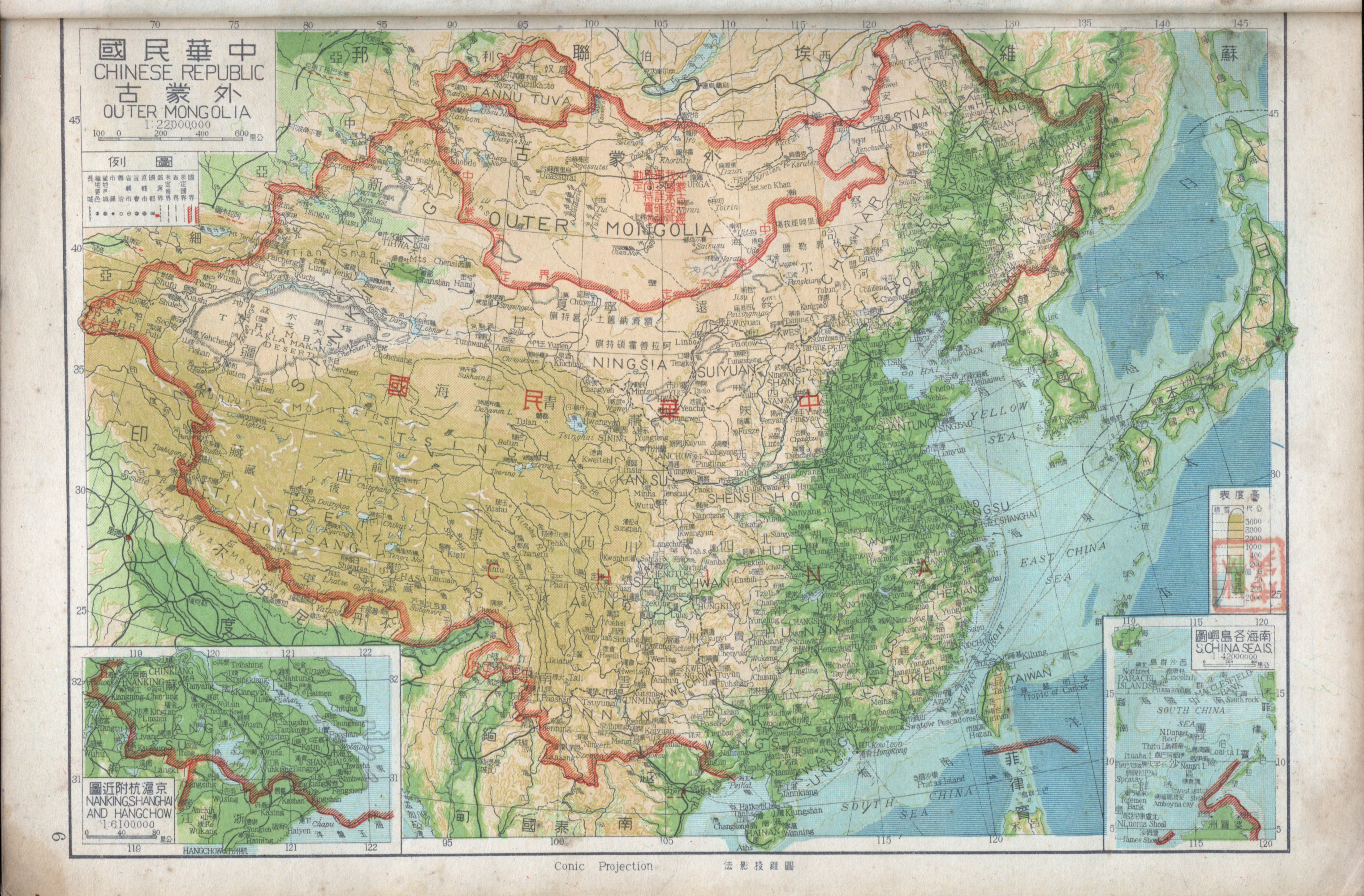
- ↑ 1947 "Chinese Republic, Outer Mongolia," 1947. p. 6. This map uses postal romanization, but with some uncommon forms of spelling.
- 1 2 fushengart (9 April 2016). "Shànghǎi gōnggòng zūjiè" 上海公共租界 [Shanghai International Settlement]. 浮生文物藝術空間 (in Chinese (Taiwan)). Retrieved 20 November 2024.
- ↑ Chinese Communist Party Central Committee, "Telegram Congratulating the Liberation of Shanghai" (30 May 1949): "China's and Asia's largest city, China's most important industrial and commercial centre, Shanghai, was liberated on the 27th."
- ↑ 张洪涛 (1 March 2005). "Dì sān zhāng:"Dōngfāng bālí"dà xuèzhàn" 第三章:"东方巴黎"大血战 [Chapter Three: The Great Battle of "Paris of the East"]. 《国殇:国民党正面战场抗战纪实》 《国殇:国民党正面战场抗战纪实》 [National Wounds: A Record of the Kuomintang's Frontal War of Resistance] (in Chinese). 团结出版社. ISBN 7-80130-975-8.
- ↑ Speech during the Battle of Shanghai, 1937.
- 1 2 "Shànghǎi shèlì `tèbié shì'--lìshǐ shàng de jīntiān wǎng" 上海設立「特別市」--歷史上的今天網 [Shanghai establishes a "Special Municipality" – This Day in History] (in Chinese). Archived from the original on 1 December 2020.
- ↑ 蔡翼 (15 January 2018). "Guófǔ fèichú bù píngděng tiáoyuē 75 zhōunián" 國府廢除不平等條約75週年 [75th anniversary of the National Government's abolition of unequal treaties]. 亞洲週刊 (in Traditional Chinese). Retrieved 20 November 2024.
{{cite web}}: CS1 maint: url-status (link) - 1 2 蔡文居 (3 March 2013). "物價飛漲一碗麵賣12萬吃完變20萬" [Soaring prices: a bowl of noodles sold for 120,000, rising to 200,000 by the time it was eaten]. Liberty Times (in Traditional Chinese). Retrieved 20 November 2024.
{{cite web}}: CS1 maint: url-status (link) - 1 2 李鎧光 (2015). "Guó gòng nèizhàn shíqí shànghǎi shì gōngwùyuán gōngzī yǔ shí mǐ gòumǎi shùliàng de biàndòng guānxì (1945-1948)" 國共內戰時期上海市公務員工資與食米購買數量的變動關係(1945-1948) [The Relationship Between Civil Servants' Wages and Rice Purchasing Capacity in Shanghai During the Chinese Civil War (1945–1948)] (PDF). National Chengchi University Historical Journal (in Chinese) (44): 133–222. Archived from the original (PDF) on 4 May 2024.
- 1 2 "A Short History of Shanghai - New York Times". The New York Times. Retrieved 2026-05-08.
- ↑ "Zhōngguó lìshǐ yán jiù yuàn" 中国历史研究院 [Institute of Chinese History]. 中国历史研究院 (in Chinese). 2 August 2022.
- ↑ "Bāyīsān'sōng hù huìzhàn wǒ yùn pàodàn zhà rìjūn sīlìng bù" 「八一三」淞滬會戰 我運炮彈炸日軍司令部 [The "August 13" Battle of Shanghai: we transported shells to bomb the Japanese military headquarters] (in Chinese). Archived from the original on 27 June 2020. Retrieved 11 March 2011.
- 1 2 3 4 "Dì yī jié tǔdì fēnbù" 第一节 土地分布 [Section 1: Land Distribution] (in Chinese). 上海市地方志办公室. Archived from the original on 20 August 2022.
- ↑ 刘统 (2018). Zhàn shànghǎi 战上海 [Battle for Shanghai] (in Chinese). Shanghai: 上海人民出版社; 学林出版社. p. 91. ISBN 978-7-5486-1484-5.
- ↑ According to the Republic of China Yearbook (《中华民国年鉴》), the simplified table of administrative regions of the ROC published by the Ministry of the Interior's regional administration department (11th edition) (《中华民国行政区域简表》(第11版)) gives 893.25 sq km, apparently including 6 counties and 13 urban-rural areas.
- ↑ Compiled and published by the Chinese Library, Collection of Key Regulations on Special Municipality Organisation (《特别市组织汇要》), 1925.
- ↑ Wei Shu, Revelations of the "Greater Shanghai Plan": Planning Changes and Spatial Evolution of the Modern Shanghai City Centre Area (“大上海计划”启示录 近代上海市中心区域的规划变迁与空间演进), Southeast University Press, January 2011.
- ↑ National Government Gazette (《国民政府公报》) No. 45, March 1928.
- ↑ Shanghai Municipal Land Administration Bureau (November 1948). Complete Map of Shanghai Municipality 《国民政府公报》 [Complete Map of Shanghai Municipality] (Map). Shanghai: Dadong Bookstore.
- ↑ "Mínguó shíqí (chūzì "shànghǎi tōng zhì" dì yī juàn "jiàn zhì yángé"" 民國時期(出自《上海通志》第一卷《建置沿革》 [The Republican Period (from Shanghai Gazetteer, Vol. 1, "Evolution of Administrative Structures")]. Archived from the original on 1 December 2017.
- 1 2 "A brief historical outline". International Services Shanghai. Retrieved 2026-05-08.
- 1 2 3 上海市政府統計處編, Shànghǎi shì gōngwù tǒngjì bàogào 上海市公務統計報告 [Shanghai Municipal Administrative Statistics Report] (PDF) (in Chinese)
- 1 2 3 4 周鈺宏編輯, Shànghǎi niánjiàn 上海年鑑 [Shanghai Yearbook] (PDF) (in Chinese), retrieved 31 August 2025
- ↑ Executive Yuan Census Office, ed. Report on the 1990 Taiwan and Fujian Area Household and Housing Census of the Republic of China (中华民国79年台闽地区户口及住宅普查报告). Taipei: Executive Yuan Census Office, 1992.
- ↑ National Government Gazette No. 3 (Ning series. 《国民政府公报》宁字第3号), 21 May 1927, p. 10.
- ↑ National Government Gazette No. 2992 (《国民政府公报》第2992号), 29 November 1947, p. 9.
- 1 2 "Zhōnghuá mínguó rénwù biǎo (chūzì "shànghǎi jiù zhèngquán jiàn zhì zhì")" 中華民國人物表(出自《上海舊政權建置志》) [Table of Republic of China figures (from Records of Shanghai's Former Administrative Structures)] (in Chinese). Archived from the original on 27 March 2016. Retrieved 15 April 2019.
- ↑ "Mínguó shíqí shànghǎi shì zhèngfǔ jiànzào píngmín zhùzhái qíngkuàng" 民国时期上海市政府建造平民住宅情况 [Public housing construction by the Shanghai Municipal Government during the Republican era] (in Chinese). Archived from the original on 12 December 2021.

Bibliography
- 鄭寶恆 (2001). “Mínguó shíqí zhèng qū yángé” 《民國時期政區沿革》 [Evolution of Administrative Regions During the Republican Period] (in Chinese). 湖北教育出版社. ISBN 9787535126610.
- 傅林祥、鄭寶-{恒}- (2007). “Zhōngguó xíngzhèng qūhuà tōngshǐ‧zhōnghuá mínguó juǎn” 《中國行政區劃通史‧中華民國卷》 [General History of Chinese Administrative Divisions: Republic of China Volume] (in Chinese). Shanghai: 復旦大學出版社. ISBN 9787309056044.
- National History Institute Geography Gazetteer Compilation Committee (1990). 《中華民國史地理志(初稿)》 [Geographical Gazetteer of the History of the Republic of China (Draft)] (in Traditional Chinese). Taipei: Academia Historica. ISBN 9579042020.
- Surveys Department, Joint Logistics Command (1970). “Zhōnghuá mínguó fèn shěng dìtú” 《中華民國分省地圖》 [Provincial Maps of the Republic of China] (in Traditional Chinese). Ministry of National Defense Intelligence Deputy Chief of Staff Office.
External links

- China Shanghai Web: Shanghai Overview, in Chinese. Archived 2011-03-12 at the Wayback Machine.
- Shanghai Local Chronicles Office, Shanghai Gazetteer in Chinese. Archived 2020-02-18 at the Wayback Machine.