Šintava
Šintava | |
|---|---|
 | |
 Flag  Coat of arms | |
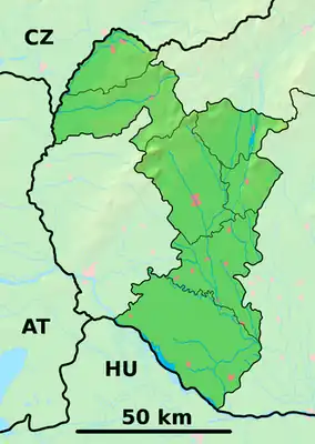  Šintava Location of Šintava in the Trnava Region  Šintava Location of Šintava in Slovakia | |
| Coordinates: 48°17′N 17°46′E / 48.28°N 17.77°E | |
| Country |  Slovakia |
| Region |  Trnava Region |
| District | Galanta District |
| First mentioned | 1074 |
| Area | |
• Total | 12.79 km2 (4.94 sq mi) |
| Elevation | 135 m (443 ft) |
| Population | |
• Total | 1,709 |
| Time zone | UTC+1 (CET) |
| • Summer (DST) | UTC+2 (CEST) |
| Postal code | 925 51[2] |
| Area code | +421 31[2] |
| Vehicle registration plate (until 2022) | GA |
| Website | www |
Šintava (Hungarian: Sempte) is a village and municipality in Galanta District of the Trnava Region of south-west Slovakia.
History

In historical records the village is first mentioned in 1042, when King Peter, the successor of Stephen I of Hungary, having been deposed from his throne united with German emperor Henry III to gain back his country. They launched campaign against King Samuel Aba who, in 1041, had been elected king by the aristocrats who had toppled King Peter. Peter and Henry conquered Pozsony (now: Bratislava) and the whole area of the river Vah, castles Šintava, Galgóc (now: Hlohovec), Bana and they reached up to river Hron.
A second written historical report comes from Vienna picture chronicle in 1074, mentioning Šintava castle as the place where overthrown King Salomon of Hungary, son of King Andrew, was given assistance by Emperor Henry IV of Germany. They fought for Salomon to regain his throne, which had been occupied by King Géza, who had his residence in Nitra. The chronicle shows: "And when the emperor came to the river Vah, Solomon rode on horseback with three formations from Šintava towards Nitra". The settlement had Hungarian majority in the 17th century according to the Turkish tax census.[4]
Before the establishment of independent Czechoslovakia in 1918, Šintava was part of Nyitra County within the Kingdom of Hungary.
Geography
The municipality lies at an altitude of 135 metres (443 ft)[2] and covers an area of 12.79 km2 (4.94 sq mi) (2025).[1]
Population
| Year | 1995 | 2005 | 2015 | 2025 |
|---|---|---|---|---|
| Count | 1608 | 1734 | 1720 | 1709 |
| Difference | +7.83% | −0.80% | −0.63% |
| Year | 2024 | 2025 |
|---|---|---|
| Count | 1712 | 1709 |
| Difference | −0.17% |
It has a population of 1709 people (31 December 2025).[6]
Ethnicity
| Ethnicity | Number | Fraction |
|---|---|---|
| Slovak | 1697 | 96.75% |
| Not found out | 46 | 2.62% |
| Total | 1754 |
In year 2021 was 1754 people by ethnicity 1697 as Slovak, 46 as Not found out, 14 as Hungarian, 6 as Czech, 4 as Other, 3 as German, 2 as Romani, 2 as Moravian, 2 as Croatian and 1 as Polish.
Note on population: The difference values of population numbers in the table "Population statistic" and in the sections "Ethnicity" & "Religion" is caused by the use of various statistical methods.
Religion
| Religion | Number | Fraction |
|---|---|---|
| Roman Catholic Church | 1181 | 67.33% |
| None | 458 | 26.11% |
| Not found out | 54 | 3.08% |
| Evangelical Church | 18 | 1.03% |
| Total | 1754 |
In year 2021 was 1754 people by religion 1181 from Roman Catholic Church, 458 from None, 54 from Not found out, 18 from Evangelical Church, 9 from Greek Catholic Church, 8 from Other, 7 from Jehovah's Witnesses, 6 from Christian Congregations in Slovakia, 5 from Ad hoc movements, 4 from Other and not ascertained christian church, 3 from Paganism and natural spirituality and 1 from Calvinist Church.
References
- 1 2 "Hustota obyvateľstva - obce [om7014rr_obc=AREAS_SK, v_om7014rr_ukaz=Rozloha (Štvorcový meter)]". Statistical Office of the Slovak Republic. 2026-03-31. Retrieved 2026-03-31.
- 1 2 3 4 "Základná charakteristika". www.statistics.sk (in Slovak). Statistical Office of the Slovak Republic. 2015-04-17. Retrieved 2022-03-31.
- ↑ "Počet obyvateľov podľa pohlavia - obce (ročne) [om7101rr_obce=AREAS_SK]". Statistical Office of the Slovak Republic. 2026-03-31. Retrieved 2026-03-31.
- ↑ Károly Kocsis, Eszter Kocsisné Hodosi, Ethnic Geography of the Hungarian Minorities in the Carpathian Basin, Simon Publications LLC, 1998, p. 46
- 1 2 "Počet obyvateľov podľa pohlavia - obce (ročne) [om7101rr_obce=AREAS_SK]". Statistical Office of the Slovak Republic. 2026-03-31. Retrieved 2026-03-31.
- ↑ "Počet obyvateľov podľa pohlavia - obce (ročne) [om7101rr_obce=AREAS_SK]". Statistical Office of the Slovak Republic. 2026-03-31. Retrieved 2026-03-31.
- ↑ "Population - Basic results". www.scitanie.sk. Statistical Office of the Slovak republic. Retrieved 2025-11-03.
- ↑ "Population - Basic results". www.scitanie.sk. Statistical Office of the Slovak republic. Retrieved 2025-11-03.
- ↑ "Population - Basic results". www.scitanie.sk. Statistical Office of the Slovak republic. Retrieved 2025-11-03.
External links
 Media related to Šintava at Wikimedia Commons