Rodney, Ontario
Rodney | |
|---|---|
Unincorporated community | |
Furnival Road Streetscape Calvary United Church Rodney Library Old Town Hall Rodney Water Tower | |
  Rodney Location of Rodney in Elgin County  Rodney Rodney (Southern Ontario) | |
| Coordinates: 42°34′1.074″N 81°40′54.0768″W / 42.56696500°N 81.681688000°W | |
| Country |  Canada |
| Province |  Ontario |
| Municipality | West Elgin |
| Population (2021)[1] | |
• Total | 1,004 |
| • Density | 483.3/km2 (1,252/sq mi) |
| Time zone | UTC-5 (EST) |
| • Summer (DST) | UTC-4 (EDT) |
| Postal codes | |
| Area code(s) | 519, 226, 548, 382 |


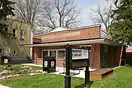


Rodney is an unincorporated community in West Elgin, Ontario, Canada. It is recognized as a designated place by Statistics Canada.
Demographics
In the 2021 Census of Population conducted by Statistics Canada, Rodney had a population of 1,004 living in 432 of its 453 total private dwellings, a change of 0.6% from its 2016 population of 998. With a land area of 2.08 km2 (0.80 sq mi), it had a population density of 482.7/km2 (1,250.2/sq mi) in 2021.[2]
See also
References
- ↑ "Census Profile for Rodney, Retired population centre (RPC) (Designated place)". 2021 Census of Canada. Statistics Canada. November 15, 2023. 98-316-X2021001. Retrieved April 25, 2026.
- ↑ "Population and dwelling counts: Canada and designated places". Statistics Canada. February 9, 2022. Retrieved January 12, 2025.