Rit'ipata (Ayacucho)
| Ritipata | |
|---|---|
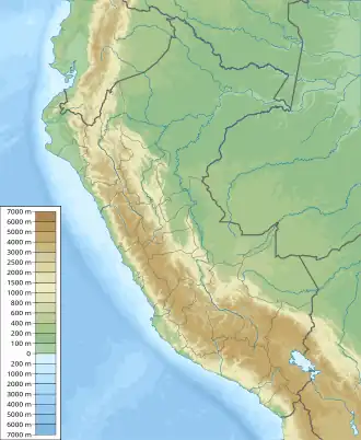  Ritipata Location within Peru | |
| Highest point | |
| Elevation | 5,000 m (16,000 ft)[1] |
| Coordinates | 13°25′45″S 74°41′30″W / 13.42917°S 74.69167°W |
| Geography | |
| Location | Perú, Ayacucho Region, Cangallo Province |
| Parent range | Andes |
Ritipata (Quechua riti snow, pata elevated place / above, at the top / edge, bank (of a river), shore,[2] also spelled Ritipata) is a mountain in the Andes of Perú, about 5,000 metres (16,404 ft) high. It is situated in the Ayacucho Region, Cangallo Province, Paras District. Ritipata lies south-west of the mountain Saywaqasa and north of the mountain Waranwallqa.[1]
References
- 1 2 escale.minedu.gob.pe - UGEL map of the Cangallo Province (Ayacucho Region)
- ↑ Teofilo Laime Ajacopa (2007). Diccionario Bilingüe: Iskay simipi yuyayk’anch: Quechua – Castellano / Castellano – Quechua (PDF). La Paz, Bolivia: futatraw.ourproject.org.