Red Hill, Trinidad and Tobago
Red Hill | |
|---|---|
Town | |
Interactive map of Red Hill | |
| Coordinates: 10°37′37.2″N 61°19′15.24″W / 10.627000°N 61.3209000°W | |
| Country | Trinidad and Tobago |
| Region | Tunapuna–Piarco |
| Population (2011)[1] | |
• Total | 2,784 |
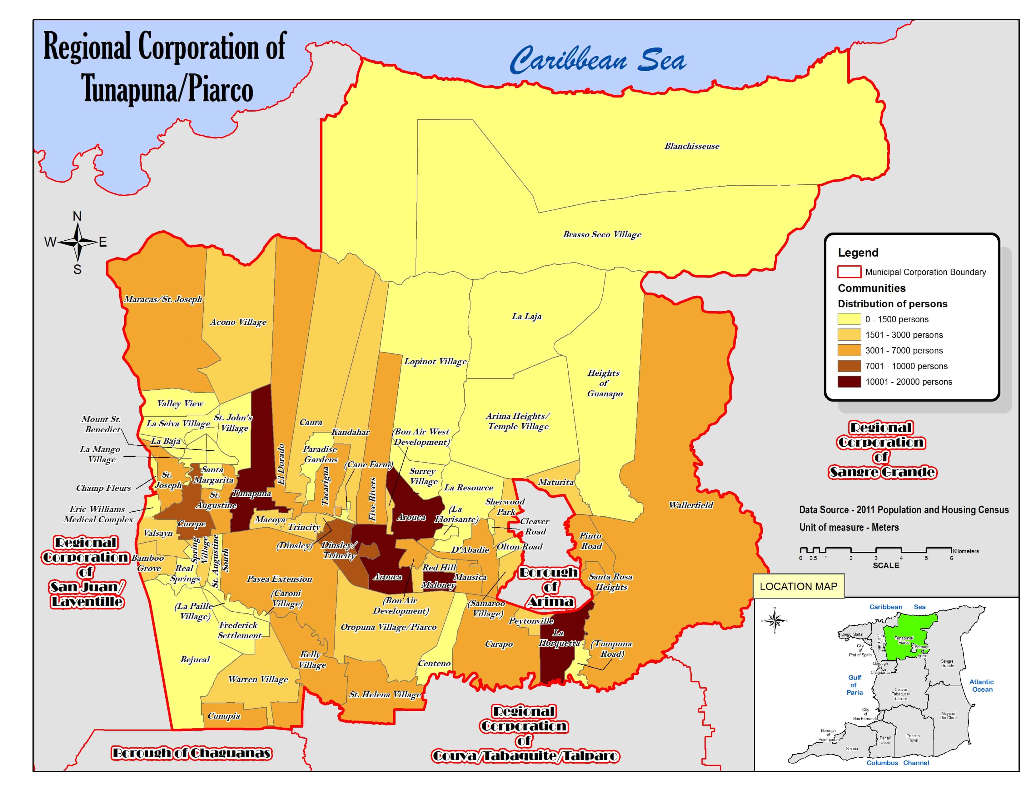
Red Hill is a town in Trinidad and Tobago, which is part of the Tunapuna–Piarco region.[2]
Toponymy
The town is also known as Redhill.[2]
Geography
The town covers part of the island of Trinidad and is bordered to the north by D'Abadie, to the south by Oropuna Village-Piarco and Maloney Gardens, to the east by Mausica, and to the west by Bon Air Development and Arouca.[3]
Demography
Demographic data for the town of Red Hill:[4]

Politics
Red Hill is part of the Arouca/Lopinot constituency for elections to the Parliament of Trinidad and Tobago.[5]
References
- ↑ https://www.citypopulation.de/en/trinidad/admin/tunapuna_piarco/3337__red_hill/
- 1 2 "Population Statistics: Demographic Profiles of Municipalities and Communities". CENTRAL STATISTICAL OFFICE. Ministry of Planning and Development (cso.gov.tt). 2023. Retrieved 26 September 2023.
- ↑ "Regional Corporation of Tunapuna/Piarco. Location map". cso.gov.tt. 2011. Retrieved 26 September 2023.
- ↑ "TRINIDAD AND TOBAGO. Municipalities and Communities: The population of the cities, boroughs, regions, parishes and communities of Trinidad and Tobago by census years". Citypopulation.de. 18 May 2020. Retrieved 26 September 2023.
- ↑ "Constituencies for 2025 Parliamentary Elections | Elections And Boundaries Commission". ebctt.com. Retrieved 2025-04-06.