Rauland Municipality
Rauland Municipality
Rauland herad | |
|---|---|
 Rural area in Rauland | |
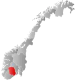 Telemark within Norway | |
 Rauland within Telemark | |
| Coordinates: 59°42′59″N 7°59′18″E / 59.71631°N 7.98844°E | |
| Country | Norway |
| County | Telemark |
| District | Vest-Telemark |
| Established | 1860 |
| • Preceded by | Vinje Municipality and Laardal Municipality |
| Disestablished | 1 Jan 1964 |
| • Succeeded by | Vinje Municipality |
| Administrative centre | Raulandsgrend |
| Area (upon dissolution) | |
• Total | 1,830.4 km2 (706.7 sq mi) |
| • Rank | #28 in Norway |
| Highest elevation | 1,630 m (5,350 ft) |
| Population (1963) | |
• Total | 1,624 |
| • Rank | #512 in Norway |
| • Density | 0.9/km2 (2.3/sq mi) |
| • Change (10 years) |  +10.9% |
| Demonym | Raulending[2] |
| Official language | |
| • Norwegian form | Nynorsk[4] |
| Time zone | UTC+01:00 (CET) |
| • Summer (DST) | UTC+02:00 (CEST) |
| ISO 3166 code | NO-0835[5] |
Rauland (Norwegian pronunciation: [ˈrɑʉlɑn]; locally [ˈrœʊlɑn]) is a former municipality in Telemark county, Norway. The 1,830.4-square-kilometre (706.7 sq mi) municipality existed from 1860 until its dissolution in 1964. The area is now part of Vinje Municipality in the traditional district of Øvre Telemark. The administrative centre was the village of Raulandsgrend (also known as Rauland) which is where Rauland Church is located.[6]
Prior to its dissolution in 1964, the 1,830.4-square-kilometre (706.7 sq mi) municipality was the 28th largest by area out of the 689 municipalities in Norway. Rauland Municipality was the 512th most populous municipality in Norway with a population of about 1,624. The municipality's population density was 0.9 inhabitants per square kilometre (2.3/sq mi) and its population had increased by 10.9% over the previous 10-year period.[7][8]
General information
Administrative history
Rauland Municipality was established in 1860 when the following areas were merged: the northeastern district of Vinje Municipality (population: 745) and the Øyfjell area of Laurdal Municipality (population: 243).[9]
During the 1960s, there were many municipal mergers across Norway due to the work of the Schei Committee.[10][11] On 1 January 1964, Rauland Municipality (population: 1,656) was dissolved and merged with Vinje Municipality (population: 2,565) to form an enlarged Vinje Municipality.[9]
Name
The municipality is named after the old Rauland prestegjeld. The prestegjeld was named after the old Rauland farm (Old Norse: Rauðaland) since the first Rauland Church was built there. The first element is rauði which means "bog iron". The last element is land which means "land" or "district". The many marshlands in the area are filled with bog iron and for centuries its production was an important local resource.[6][12]
Churches
The Church of Norway had three parishes (sokn) within Rauland Municipality. At the time of the municipal dissolution, it was part of the Rauland prestegjeld and the Vest-Telemark prosti (deanery) in the Diocese of Agder.[8]
| Parish (sokn) | Church name | Location of the church | Year built |
|---|---|---|---|
| Rauland | Rauland Church | Raulandsgrend | 1803 |
| Møsstrond | Møsstrond Church | Møsstrond | 1923 |
| Øyfjell | Øyfjell Church | Øyfjell | 1833 |
Geography
The municipality was a very mountainous, rural area, with about 90% of its area at elevations of 900 metres (3,000 ft) above sea level or higher.[6] The highest point in the municipality was the 1,630-metre (5,350 ft) tall mountain Fliseggi.[1] Ullensvang Municipality (in Hordaland county) was located to the northwest, Nore og Uvdal Municipality (in Buskerud county) was located to the north, Tinn Municipality was located to the east, Seljord Municipality was located to the southeast, Lårdal Municipality was located to the south, and Vinje Municipality was located to the west.
Government
While it existed, Rauland Municipality was responsible for primary education (through 10th grade), outpatient health services, senior citizen services, welfare and other social services, zoning, economic development, and municipal roads and utilities. The municipality was governed by a municipal council of directly elected representatives. The mayor was indirectly elected by a vote of the municipal council.[13] The municipality was under the jurisdiction of the Vest-Telemark District Court and the Agder Court of Appeal.
Municipal council
The municipal council (Heradsstyre) of Rauland Municipality was made up of 21 representatives that were elected to four year terms. The tables below show the historical composition of the council by political party.
| Party name (in Nynorsk) | Number of representatives | |
|---|---|---|
| Labour Party (Arbeidarpartiet) | 13 | |
| Centre Party (Senterpartiet) | 4 | |
| Joint List(s) of Non-Socialist Parties (Borgarlege Felleslister) | 4 | |
| Total number of members: | 21 | |
| Note: On 1 January 1964, Rauland Municipality became part of Vinje Municipality. | ||
| Party name (in Nynorsk) | Number of representatives | |
|---|---|---|
| Labour Party (Arbeidarpartiet) | 13 | |
| Joint List(s) of Non-Socialist Parties (Borgarlege Felleslister) | 8 | |
| Total number of members: | 21 | |
| Party name (in Nynorsk) | Number of representatives | |
|---|---|---|
| Labour Party (Arbeidarpartiet) | 12 | |
| Joint List(s) of Non-Socialist Parties (Borgarlege Felleslister) | 8 | |
| Total number of members: | 20 | |
| Party name (in Nynorsk) | Number of representatives | |
|---|---|---|
| Labour Party (Arbeidarpartiet) | 8 | |
| Joint list of the Liberal Party (Venstre) and the Radical People's Party (Radikale Folkepartiet) | 1 | |
| Local List(s) (Lokale lister) | 11 | |
| Total number of members: | 20 | |
| Party name (in Nynorsk) | Number of representatives | |
|---|---|---|
| Labour Party (Arbeidarpartiet) | 9 | |
| Joint list of the Liberal Party (Venstre) and the Radical People's Party (Radikale Folkepartiet) | 1 | |
| Local List(s) (Lokale lister) | 10 | |
| Total number of members: | 20 | |
| Party name (in Nynorsk) | Number of representatives | |
|---|---|---|
| Local List(s) (Lokale lister) | 20 | |
| Total number of members: | 20 | |
| Note: Due to the German occupation of Norway during World War II, no elections were held for new municipal councils until after the war ended in 1945. | ||
Notable people
- Sveinung Svalastoga (1772–1809), a rose-painter, poet and woodcarver
- Rikard Berge (1881–1969), a folklorist, museologist, and magazine editor
- Aslaug Vaa (1889–1965), a poet and playwright
- Olav Aslakson Versto (1892–1977), a Norwegian politician for the Norwegian Labour Party
- Dyre Vaa (1903–1980), a sculptor and painter
See also
References
- 1 2 "Kart over Norge" (in Norwegian). Kartverket.
- ↑ "Navn på steder og personer: Innbyggjarnamn" (in Norwegian). Språkrådet.
- ↑ "Forskrift om målvedtak i kommunar og fylkeskommunar" (in Norwegian). Lovdata.no.
- ↑ "Norsk Lovtidende. 2den Afdeling. 1932. Samling af Love, Resolutioner m.m". Norsk Lovtidend (in Norwegian). Oslo, Norway: Grøndahl og Søns Boktrykkeri: 453–471. 1932.
- ↑ Bolstad, Erik; Thorsnæs, Geir, eds. (9 January 2024). "Kommunenummer". Store norske leksikon (in Norwegian). Foreningen Store norske leksikon.
- 1 2 3 Lundbo, Sten; Mæhlum, Lars, eds. (5 May 2026). "Rauland". Store norske leksikon (in Norwegian). Foreningen Store norske leksikon. Retrieved 30 August 2026.
- ↑ Statistisk sentralbyrå. "Table: 06913: Population 1 January and population changes during the calendar year (M)" (in Norwegian).
- 1 2 Statistisk sentralbyrå (1 January 1951). Norges Sivile, Geistlige, Rettslige og Militære Inndeling 1. Januar 1951 (PDF). Norges Offisielle Statistikk (in Norwegian). Oslo, Norge: H. Aschehoug & Co.
- 1 2 Jukvam, Dag (1999). "Historisk oversikt over endringer i kommune- og fylkesinndelingen" (PDF) (in Norwegian). Statistisk sentralbyrå. ISBN 9788253746845.
{{cite web}}: CS1 maint: periodical has ISBN (link) - ↑ Grepstad, Jon, ed. (25 March 2025). "Nikolai Schei". Store norske leksikon (in Norwegian). Foreningen Store norske leksikon. Retrieved 19 March 2026.
- ↑ Hansen, Tore; Thorsnæs, Geir, eds. (27 May 2024). "kommuneinndelingen i Norge". Store norske leksikon (in Norwegian). Foreningen Store norske leksikon. Retrieved 19 March 2026.
- ↑ Rygh, Oluf (1914). Norske gaardnavne: Bratsbergs amt (in Norwegian) (7 ed.). Kristiania, Norge: W. C. Fabritius & sønners bogtrikkeri. p. 465.
- ↑ Hansen, Tore; Vabo, Signy Irene, eds. (25 November 2024). "kommunestyre". Store norske leksikon (in Norwegian). Foreningen Store norske leksikon. Retrieved 31 December 2024.
- ↑ "Kommunevalgene og Ordførervalgene 1959" (PDF) (in Norwegian). Oslo, Norge: Statistisk sentralbyrå. 1960.
- ↑ "Kommunevalgene og Ordførervalgene 1955" (PDF) (in Norwegian). Oslo, Norge: Statistisk sentralbyrå. 1957.
- ↑ "Kommunevalgene og Ordførervalgene 1951" (PDF) (in Norwegian). Oslo: Statistisk sentralbyrå. 1952.
- ↑ "Kommunevalgene og Ordførervalgene 1947" (PDF) (in Norwegian). Oslo: Statistisk sentralbyrå. 1948.
- ↑ "Kommunevalgene og Ordførervalgene 1945" (PDF) (in Norwegian). Oslo: Statistisk sentralbyrå. 1947.
- ↑ "Kommunevalgene og Ordførervalgene 1937" (PDF) (in Norwegian). Oslo: Statistisk sentralbyrå. 1938.
Places adjacent to Rauland Municipality | ||||||||||||||||
|---|---|---|---|---|---|---|---|---|---|---|---|---|---|---|---|---|
| ||||||||||||||||


| |||||||
 | Towns and cities | ||||||
| Municipalities |
| ||||||
| |||||||