Ottstedt am Berge
Ottstedt am Berge | |
|---|---|
Location of Ottstedt am Berge | |
  Ottstedt am Berge Location within Germany 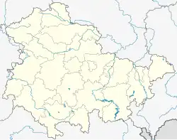 Ottstedt am Berge Location within Thuringia | |
| Coordinates: 51°1′2″N 11°12′49″E / 51.01722°N 11.21361°E | |
| Country | Germany |
| State | Thuringia |
| District | Weimarer Land |
| Municipality | Grammetal |
| Area | |
• Total | 5.11 km2 (1.97 sq mi) |
| Elevation | 240 m (790 ft) |
| Population (2018-12-31) | |
• Total | 241 |
| • Density | 47.2/km2 (122/sq mi) |
| Time zone | UTC+01:00 (CET) |
| • Summer (DST) | UTC+02:00 (CEST) |
| Postal codes | 99428 |
| Dialling codes | 036203 |
| Vehicle registration | AP |
Ottstedt am Berge (German pronunciation: [ˈɔtʃtɛt ʔam ˈbɛʁɡə], lit. 'Ottstedt on the Mountain') is a village and a former municipality in the Weimarer Land district of Thuringia, Germany. Since December 2019, it is part of the municipality Grammetal.[1][2]
Geography
Ottstedt lies approximately ten kilometers northeast of the state capital Erfurt and ten kilometers northwest of Weimar on the southwestern slope of the Ettersberg hill, where the Buchenwald concentration camp once stood.
Neighboring municipalities and towns include Hopfgarten, Niederzimmern, Ollendorf, Am Ettersberg, and the city of Weimar.[3]
References
- ↑ "Über die Ortschaft – Grammetal" (in German). Archived from the original on 2026-05-17. Retrieved 2026-05-06.
- ↑ Newsflash24 (2026-04-12). "Weimar: Tragischer Unfall in Ottstedt am Berge". Newsflash24 (in German). Archived from the original on 2026-05-18. Retrieved 2026-05-06.
{{cite web}}: CS1 maint: numeric names: authors list (link) - ↑ https://parldok.thueringer-landtag.de/