Nanango Weir
| Nanango Weir | |
|---|---|
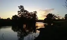 Dusk at the weir | |
  Nanango Weir Location of the dam in Queensland | |
Interactive map of Nanango Weir | |
| Country | Australia |
| Location | Nanango, Wide Bay–Burnett, Queensland |
| Coordinates | 26°39′01″S 151°55′28″E / 26.650182°S 151.924437°E |
| Purpose | Irrigation |
| Status | Operational |
| Operator | SunWater |
| Dam and spillways | |
| Type of dam | Barrage |
| Impounds | Barkers Creek |
The Nanango Weir is a minor weir across Barkers Creek, located approximately 9.6 kilometres (6.0 mi) north-west of Nanango, in the Wide Bay–Burnett region of Queensland, Australia.[1]
The weir, located upstream of the Bjelke-Petersen Dam and south of Kingaroy, is part of the Barker Barambah Water Supply Scheme that is administered by SunWater.[2] The original purpose of the weir was for irrigation of adjacent farms for agricultural use, though public recreation is now permitted.
Recreation
The weir is widely unknown to the public because of its unsigned location and small access track. The weir is a great spot for canoeing, picnics and other watersports. There is no constructed boat ramps and large vessels or motors are highly discouraged. The weir is usually full though long dry periods can affect water levels.
See also
References
- ↑ "Community access to state-owned dams and weirs". Environment: Dams and catchment areas. Queensland Government. Retrieved 5 March 2025.
- ↑ "Barker Barambah Water Supply Scheme: Schematic Map" (PDF). Sunwater. June 2022. Retrieved 18 March 2026.
External links
- "Burnett Basin water plan area" (PDF) (Map). Department of Local Government, Water, and Volunteers. Queensland Government. Retrieved 18 March 2026.
- MacDonald, Angus; Maclaine, Duncan; Smith, Cameron; Hewitt, Chris; Vanderbyl, Tom (October 2020). "Water supply requirements in the North and South Burnett: Options Analysis" (PDF). Jacobs Australia. South Burnett Regional Council. Retrieved 18 March 2026.
- "Queensland's water plans in a variable and changing climate | Burnett Basin" (PDF). Department of Regional Development, Manufacturing and Water. Queensland Government. December 2023. p. 38. Retrieved 18 March 2026.
Water supply in Queensland, Australia | |||||||||||||
|---|---|---|---|---|---|---|---|---|---|---|---|---|---|
| |||||||||||||

