Mount Butin
| Mount Butin | |
|---|---|
| Butin, Botin | |
 Mount Butin in April 2016 | |
| Highest point | |
| Elevation | 2,534 m (8,314 ft) |
| Coordinates | 37°04′40″N 44°09′21″E / 37.07778°N 44.15583°E |
| Naming | |
| Nickname | Kurdish: بۆتین |
| Native name | |
| Geography | |
  Mount Butin Location within Iraqi Kurdistan 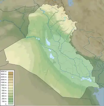 Mount Butin Location within Iraq | |
| Location | Kurdistan Region, Iraq |
Country |  Iraq |
Region |  Kurdistan Region |
Mzuri Bala | Mzuri Bala |
| Parent range | Zagros Mountains |
Butin or Botin (Kurdish: بۆتین, Botîn)[1][2] located on the Pendro terrain in Kurdistan Region.[3][4] The mountain lies 4 km (2 mi) to the northeast of Pendro and some 100 km (62 mi) from Erbil. Hunting in Butin is prohibited and it is home to a large population of Wild Goat and other wildlife. Butin has a lot of valuable trees and mountain herbs, the most extensive growths on the Butin slopes.[5][6]
Photo gallery
 Mount Butin, captured on May 9, 2010
 Mount Butin from Chemma, photographed on April 8, 2016
 A wild goat spotted near Mount Butin
 Mount Butin in winter, showing the snowy landscape
 View of Pendro village with Mount Butin in the background
 Winter view of Mount Butin from Chemma
 Members of the Kurdistan Mountain Climbing Federation, 2015
 Another image of the Kurdistan Mountain Climbing Federation, 2015
References
- ↑ "Li Mêrgesor ji ber şerê PKK û Tirkiyê kesek şehîd bûye-ARK NEWS". www.arknews.net (in Kurdish). Archived from the original on 20 December 2019. Retrieved 20 December 2019.
- ↑ "بۆتین ئالای كوردستانی بهرز كردهوه ... ئا: زوهری ئێدلبی". www.kurdistannet.biz. Retrieved 20 December 2019.
- ↑ "Pendro Village". www.archive.org (in Kurdish). 2015.
- ↑ "Pendro - Wikimapia". wikimapia.org. Archived from the original on 2019-02-02. Retrieved 2017-05-17.
- ↑ "Kurd Flora". www.kurdflora.com. Archived from the original on 2018-09-28. Retrieved 2017-05-17.
- ↑ "The Kurdistan Region's flora and fauna". Archived from the original on 2018-08-17. Retrieved 2017-05-08.