Mercoal, Alberta
Mercoal | |
|---|---|
 Mercoal, shortly after mine closure, Spring 1960 | |
  Mercoal Location within Yellowhead County 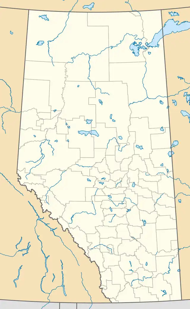 Mercoal Location within Alberta | |
| Coordinates: 53°09′37″N 117°05′43″W / 53.16028°N 117.09528°W | |
| Country | Canada |
| Province | Alberta |
| Municipal district | Yellowhead County |
| Government | |
| • Type | Unincorporated |
| • Mayor | Jim Eglinski |
| • Governing body | Yellowhead County Council
|
| Time zone | UTC−06:00 (Alberta Time) |
| Area codes | 780, 587, 825 |
Mercoal, a former coal mining community, is a ghost town located in Yellowhead County, Alberta, Canada.[1][2] Situated on Highway 40, it is located 6 km (4 mi) from Coalspur and 11 km (7 mi) from Robb.[3]
Toponymy
Mercoal is an acronym for the McLeod River Hard Coal Company, which opened a mine in the area in 1920.[1]
Topography
Mercoal's terrain is characterized by shallow valleys and gentle slopes.[4][5] Its soils are predominantly clay loam, formed from glacial till, which range from poorly drained to well drained.[4][5]
Flora and fauna
Plants native to the Mercoal area include evening primrose, Jacob's-ladder, northern arnica, mountain strawberry, and the common yarrow.[5] Mercoal Creek, which borders the original townsite, is travelled by Brook trout.[6]
History
Founding: 1910–1920
Mercoal was one of the communities created by the Grand Trunk Pacific Railway (GTPR) after 1910, when the GTPR began constructing a line from Edmonton to the British Columbia Coast.[7] Known as the Coal Branch line, it was built to transport coal being mined in the area.[7][8] The GTPR reached Mercoal in 1913.[9]
In 1920, the McLeod River Hard Coal Company opened a mine that gave the settlement its name.[1][10] Coal produced by the mine was suitable for use by Alberta's railways, and the area developed into a mining community.[1][8]
Early development and unrest: 1921–1940
Mercoal quickly became host to commercial establishments including a general store, coffeehouse, pool room, and hardware store.[8][11] A post office opened in January 1922.[12] Children in Mercoal attended a school in nearby Coalspur until Mercoal School opened to serve the growing community.[13][10]
Single men who worked in the mines lived in boarding houses with a shared cookhouse and dining room.[14] Mercoal was unusual for a Coal Branch settlement in that its demographics settled along ethnic lines, with miners from Ukraine gathering on a hill to the northeast.[15] This was likely due to space requirements: many of these miners kept chickens or cattle, necessitating their separation from the townsite.[15]
The McLeod River Hard Coal Company sold Mercoal's mine to the Saunders Ridge Coal Company in 1924.[10] Forest fires that broke out in 1929 briefly threatened the settlement until summer rains wetted the grassland surrounding Mercoal, sparing it from the fire's path.[16]
In June 1930, a dispute arose between the United Mine Workers of America (UMWA) and Mine Workers' Union of Canada (MWUC) regarding which union represented Mercoal's workers.[16] The dispute began when the mine's owners signed an agreement with the UMWA, without consulting the miners.[17] Supported by the MWUC, between 30 and 70 of the mine's 80 workers went on strike.[17] Politician Christopher Pattinson suggested that a referendum should be held to allow all workers to decide which union they preferred, but the UMWA refused the proposal.[17]
On July 23, the RCMP attended Mercoal in a bid to quell rising hostilities, and a riot erupted.[16][17] The RCMP requested support from the Alberta Provincial Police, resulting in over 120 armed police officers attending Mercoal the next day.[16][17] The union dispute ended with Mercoal's workers opting to join the MWUC.[16]
Wartime expansion and decline: 1941–2000
Canadian Collieries Ltd. acquired the mine in 1940,[16] amid a period of rising demand for coal caused by the Second World War.[18] At this time, Mercoal had 200 residents; its population grew to 850 by 1946.[1] Mercoal's production increased from 500 tons a day to 1,200 by 1942.[16] Increased mining activity generated an economic boom for Mercoal, which received a theatre, gas station, and General Motors dealership.[18] Mercoal's name was accepted by the Government of Canada for mapping purposes in 1944.[19]
By 1952, Mercoal's mine was the only major producer in the area,[16] as mines in nearby Cadomin and Mountain Park closed in quick succession.[1][20] Miners from surrounding areas relocated to Mercoal for work, and the community's population reached a peak of 1,000.[1][16] Mercoal Hospital, an eight-bed facility, also opened that year to accommodate the growing populace.[16] Nonetheless, demand for coal continued to decline throughout the 1950s until Mercoal's mine closed on July 17, 1959.[1][16][20] Between the closure of mines in Mercoal and Drumheller that year, 1,200 miners were out of work,[21] and Mercoal began to rapidly depopulate.[18]
| Year | Pop. | ±% |
|---|---|---|
| 1941 | 91 | — |
| 1951 | 977 | +973.6% |
| 1956 | 972 | −0.5% |
| Source: Statistics Canada[22][23] | ||
In 1968, writer Robert Kroetsch described Mercoal as having a population of two.[24] Mercoal's post office closed permanently in May of that year.[12] A local history published in 1979 described Mercoal as "no longer on the map."[25]
21st century: 2001–present
Only the foundations of the original Mercoal townsite are extant in the 21st century.[1][16] Mercoal is therefore often referred to as a ghost town,[26] though the vicinity is home to some residential properties, for which Mercoal remains in use as a toponym.[27][28]
The provincial government contemplated evacuating Mercoal's residents due to a winter wildfire in December 2018, though this order was ultimately aborted.[27] Residents of Mercoal were temporarily evacuated in June 2025 during the 2025 Canadian wildfires.[2][29]
References
- 1 2 3 4 5 6 7 8 9 National Trust for Canada. "Mercoal, Alberta". Historic Places Days. Retrieved August 29, 2026.
- 1 2 Snowdon, Wallis (June 2, 2025). "Wildfire evacuation orders to lift Tuesday in Yellowhead County". CBC News.
- ↑ Government of Canada, Natural Resources Canada. "Place names - search-place-names". geonames.nrcan.gc.ca. Retrieved August 29, 2026.
- 1 2 Centre (Canada), Northern Forest Research; Yang, Richard C. (1985). Ten-year Growth Response of 70-year-old Lodgepole Pine to Fertilization in Alberta. Northern Forest Research Centre. p. 1. ISBN 978-0-662-13675-0.
- 1 2 3 Russell, William Bacon (1980). The Vascular Flora and Natural Vegetation of Abandoned Coal Mined Land, Rocky Mountain Foothills, Alberta. University of Alberta. pp. 7, 92–96. ISBN 978-0-315-01234-9.
- ↑ Mines, Alberta Department of Lands and (1946). Annual Report of the Department of Lands and Mines of the Province of Alberta. King's Printer. Department of Lands and Mines. p. 81.
- 1 2 Nelson, Jessica (July 13, 2022). "Passport to Summer: These northern Alberta ghost towns are worth a visit". Lakeland Today.
- 1 2 3 Lakevold, Courtney (February 3, 2016). "Yellowhead Townsite and Mine: Archaeology in Alberta's Coal Branch". Alberta's Historic Places.
- ↑ Alberta Culture (January 2025). "Mercoal". Alberta Geographical Names Web Map. Select yellow circle.
- 1 2 3 Ross, Toni Antoniuk (1974). Oh! The Coal Branch: A Chronicle of the Alberta Coal Branch. Ross. p. 59.
- ↑ Bargery, Mary; Library, Hinton Municipal (1999). Picture Hinton, Entrance, Brule and Cadomin. Hinton Municipal Library. pp. 130–133. ISBN 978-0-9686199-0-2.
- 1 2 Library and Archives Canada (August 25, 2026). "Mercoal". Archives / Post Offices and Postmasters.
- ↑ Richler, Noah (May 18, 2011). This Is My Country, What's Yours?: A Literary Atlas of Canada. McClelland & Stewart. p. 230. ISBN 978-1-55199-417-8.
- ↑ Bowles, Roy Tyler (1982). Little Communities and Big Industries: Studies in the Social Impact of Canadian Resource Extraction. Butterworths. p. 146. ISBN 978-0-409-81610-5.
- 1 2 Lake, David (1967). The Historical Geography of the Coal Branch. University of Alberta. p. 45.
- 1 2 3 4 5 6 7 8 9 10 11 12 Fryer, Harold (1976). Ghost Towns of Alberta. Stagecoach Publishing Company. pp. 144–145. ISBN 978-0-88983-004-2.
- 1 2 3 4 5 Caragata, Warren (1979). Alberta Labour: A Heritage Untold. James Lorimer Limited. p. 113. ISBN 978-1-4593-2362-9.
- 1 2 3 Bachusky, Johnnie (2003). Ghost Town Stories: Abandoned Dreams in the Shadows of the Canadian Rockies : History. Altitude Pub. Canada. pp. 51–55. ISBN 978-1-55153-993-5.
- ↑ Government of Canada, Natural Resources Canada. "Place names - Mercoal". geonames.nrcan.gc.ca. Retrieved August 29, 2026.
- 1 2 Kyba, Daniel and Jane Ross (2001). Exploring the historic Coal Branch. Calgary, Alberta: Rocky Mountain Books, 336 p. ISBN 0-921102-83-6.
- ↑ Education, Alberta Department of (1959). Annual Report of the Department of Education of the Province of Alberta. Department of Education. p. 18.
- ↑ Ninth Census of Canada, 1951 (PDF). Vol. SP-7 (Population: Unincorporated villages and hamlets). Dominion Bureau of Statistics. March 31, 1954. pp. 55–57. Retrieved October 24, 2021.
- ↑ Census of Canada, 1956 (PDF). Vol. Population of unincorporated villages and settlements. Dominion Bureau of Statistics. October 25, 1957. pp. 56–59. Retrieved October 24, 2021.
- ↑ Kroetsch, Robert (1968). Alberta. St. Martin's Press. p. 68.
- ↑ Society, Eckville and District Historical (1979). Homesteads and Happiness. Eckville and District Historical Society. p. 611. ISBN 978-0-919213-85-2.
- ↑ Jeffrey, Robbie. "Rural Frontiers". www.ualberta.ca. Retrieved August 29, 2026.
- 1 2 CBC (December 15, 2018). "Winter wildfire a reminder for Albertans to exercise caution year-round". CBC News.
- ↑ Fitzhugh, Jasper (May 30, 2025). "Mercoal wildfire being held, Peers evacuated in separate blaze". Rocky Mountain Outlook.
- ↑ Ekelund, Brittany (June 4, 2025). "Half of Chipewyan Lake destroyed by fire, others wildfire evacuees return home". CTVNews. Retrieved August 29, 2026.