Meluzína
| Meluzína | |
|---|---|
 Path on the Meluzína or Wirbelstein | |
| Highest point | |
| Elevation | 1,094.1 m n.m. (3,590 ft) |
| Coordinates | 50°23′25″N 13°00′28″E / 50.39028°N 13.00778°E |
| Geography | |
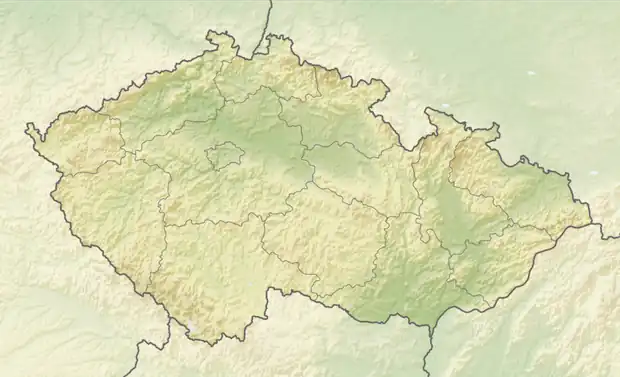  Meluzína Location within Czech Republic | |
| Location | Karlovarsky kraj, Czech Republic |
| Parent range | Ore Mountains |
| Geology | |
| ridge | |
| Rock type | eclogite |
The Meluzína (German: Wirbelstein) is a 1,094-metre-high (3,589 ft) mountain in the central Ore Mountains in the Czech Republic.
Location
The Meluzína or Wirbelstein lies three kilometres east of the highest peak in the range, the Klínovec, near the road from Boží Dar to Měděnec on the actual crest of the Ore Mountains.
Ascents
- The Meluzína lies on the red marked ridgeway of the Ore Mountains (European walking route E3). An ascent of the summit is possible over an unmarked branching trail.
- The road from Boží Dar to Měděnec is also a good starting point (turn off to Pod Meluzínou).
Geology
Many minerals can be seen in coarse-grained bands.[1]
- Quartz
- Amphibole
- Zoisite
Views
- West
- North
- Fichtelberg
- Wind turbines near Háj u Loučné
- Bärenstein
- Pöhlberg
- Wind power station near Jöhstadt
- East
- Velký Špičák
- Jelení hora
- Kupferhübel mit Měděnec
- Brown coal power station near Kadaň
- South
- Ohře valley and Ostrov nad Ohří
 Rocks on the Meluzína
 On the summit of the Meluzína
References
- ↑ "Meluzína hill, Krásný Les, Karlovy Vary District, Karlovy Vary Region, Czech Republic". www.mindat.org. Retrieved 2026-01-28.