Kamsdorf
Kamsdorf | |
|---|---|
 Coat of arms | |
Location of Kamsdorf | |
  Kamsdorf Location within Germany 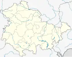 Kamsdorf Location within Thuringia | |
| Coordinates: 50°38′41″N 11°26′41″E / 50.64472°N 11.44472°E | |
| Country | Germany |
| State | Thuringia |
| District | Saalfeld-Rudolstadt |
| Municipality | Unterwellenborn |
| Area | |
• Total | 6.90 km2 (2.66 sq mi) |
| Highest elevation | 400 m (1,300 ft) |
| Lowest elevation | 325 m (1,066 ft) |
| Population (2016-12-31) | |
• Total | 2,653 |
| • Density | 384/km2 (996/sq mi) |
| Time zone | UTC+01:00 (CET) |
| • Summer (DST) | UTC+02:00 (CEST) |
| Postal codes | 07334 |
| Dialling codes | 03671 |
| Vehicle registration | SLF |
Kamsdorf is a village and a former municipality in the district Saalfeld-Rudolstadt, in Thuringia, Germany. Since July 2018, it is part of the municipality Unterwellenborn.
History
Within the German Empire (1871–1918), Kamsdorf was part of the Prussian Province of Saxony.
References