Hurepoix
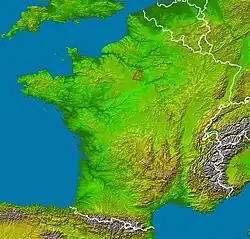
Hurepoix (French pronunciation: [yʁpwa]) is an area of the Île-de-France, to the southwest of Paris, situated between the departments of Yvelines, Hauts-de-Seine and Essonne. It was an old province of the French Kingdom and the main city was Dourdan. The name appears to come from the old French words for wild boar, hure and bristles, poil.[1]
Geography
This area is one of the biggest of the Île-de-France.
Limits :
- North : Paris, by the Paris Observatory[1]
- West : Rambouillet and forest
- East : Seine, Brie province, Fontainebleau and forest
- South : Beauce province
Main cities
Main rivers
Main forest
Main Castles
This area is not far from Versailles, and the castle of Louis XIV. In this period, Princes and Dukes built castles not far, in Hurepoix.
- Chamarande
- Breteuil
- Courson
- Dampierre
- Dourdan
- Sceaux
- Saint Jean de Beauregard
Economy
The economy of the west part of the area consists of farming, as in the past. The economy of the eastern part is more industrial.
References
- 1 2 Robb, Graham (2022). France: An Adventure History. W.W. Norton. ISBN 9781324002574. Retrieved 7 August 2026.
Categories: