Hohlstedt
Hohlstedt | |
|---|---|
Location of Hohlstedt | |
  Hohlstedt Location within Germany 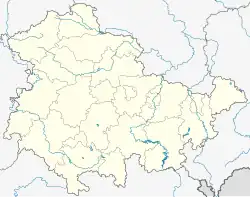 Hohlstedt Location within Thuringia | |
| Coordinates: 50°57′36″N 11°28′45″E / 50.96000°N 11.47917°E | |
| Country | Germany |
| State | Thuringia |
| District | Weimarer Land |
| Town | Großschwabhausen |
| Area | |
• Total | 4.13 km2 (1.59 sq mi) |
| Elevation | 305 m (1,001 ft) |
| Population (2006-12-31) | |
• Total | 238 |
| • Density | 57.6/km2 (149/sq mi) |
| Time zone | UTC+01:00 (CET) |
| • Summer (DST) | UTC+02:00 (CEST) |
| Postal codes | 99441 |
| Dialling codes | 036425 |
Hohlstedt is a former municipality in the Weimarer Land district of Thuringia, Germany. Since 1 December 2007, it is part of the municipality Großschwabhausen.
Geography
Federal Highway 7 runs between Hohlstedt and Kötschau, connecting Jena and Weimar. The village lies on a gently rising plateau in the agricultural plain around Weimar and Apolda. It is situated amidst gardens and fields.
History
The village was first documented on 2 December 958.[1] It was and remains predominantly agricultural. The listed Eulenstein farmstead is a notable landmark.[2]
References
- ↑ Wolfgang Kahl: First Mention of Thuringian Towns and Villages. A Handbook. 5th, revised and significantly expanded edition. Rockstuhl, Bad Langensalza 2010, ISBN 978-3-86777-202-0, p. 127.
- ↑ "Hohlstedt | Gemeinde Großschwabhausen (Thüringen)" (in German). Retrieved 2026-07-23.