Elsloo, Limburg
Elsloo
Aelse | |
|---|---|
Village | |
 Op de Berg, seen from Maasberg | |
 Coat of arms | |
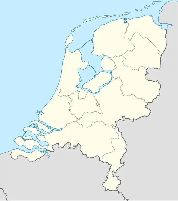  Elsloo Location in the Netherlands  Elsloo Location in Limburg in the Netherlands | |
| Coordinates: 50°57′1″N 5°46′7″E / 50.95028°N 5.76861°E | |
| Country | Netherlands |
| Province | Limburg |
| Municipality | Stein |
| Area | |
• Total | 3.64 km2 (1.41 sq mi) |
| Elevation | 68 m (223 ft) |
| Population (1 January 2025)[1] | |
• Total | 6,905 |
| • Density | 1,900/km2 (4,910/sq mi) |
| Elsloo neighbourhood; the wider statistical district, including Meers and Catsop, had 8,295 residents. | |
| Time zone | UTC+1 (CET) |
| • Summer (DST) | UTC+2 (CEST) |
| Postal code | 6181 |
| Dialling code | 046 |
| Website | Elsloo.info |
Elsloo (Limburgish: Aelse) is a village in the municipality of Stein, in the southern part of the Dutch province of Limburg. It lies on the eastern edge of the Meuse valley, beside the Juliana Canal. The statistical neighbourhood corresponding to the village had 6,905 residents on 1 January 2025. The wider statistical district, which also includes Meers and Catsop, had 8,295 residents.[1] The historic village centre and the grounds of Elsloo Castle have formed a nationally protected village conservation area since 1971.[3]
Geography and landscape
Elsloo is situated where the low-lying Meuse valley meets the loess-covered plateau of South Limburg. The old village occupies a steep slope above the river, while most twentieth-century development lies farther east and north. The Juliana Canal separates the village from the Meuse; the Belgian village of Kotem lies across the river. The A76 motorway marks the northern edge of the built-up area. At Elsloo, the Scharberg Bridge carries the motorway across both the canal and the Meuse. The bridge opened in 1973 and continues westward as the Belgian A2.[4]
South of the village are the castle park and Elslooërbos, which continues into the Bunderbos. Together with other woods between Elsloo and Bunde, these slopes form the approximately 190-hectare (470-acre) Bunder- en Elslooërbos Natura 2000 site. Its protected habitats include old hillside woodland, spring-fed streams and calcareous tufa springs.[5][6]
The nineteenth-century castle park contains deciduous woodland, ponds, springs, small waterfalls and winding paths. The Hemelbeek connects several of the ponds, while the Slakbeek feeds the historic watermill. A roughly one-hectare botanical garden was established in 1969 and is maintained by the local branch of the Dutch nature organisation IVN.[7][8] Since about 2010, beavers have settled along the lower Hemelbeek. Their dams have made parts of the valley wetter. After the animals expanded into the Poortlossing, the water level there rose locally by about one metre and several tufa springs were submerged.[9]
History
Prehistory and Roman period
The Elsloo area is an important archaeological site of the Linear Pottery culture. Between approximately 5300 and 4900 BC, some of the earliest permanent farming communities in the present-day Netherlands lived here. Excavations have uncovered around one hundred house plans and a burial ground.[10] The cemetery, used around 5000 BC, has been described as the oldest known burial ground in the Netherlands. Finds excavated in 1959 and 1960 have been re-examined using modern research methods.[11][12] The frequently used description of Elsloo as the “oldest farming village of the Netherlands” refers to these prehistoric remains, not to uninterrupted occupation of the present village.
Later archaeological evidence includes remains from the Bronze Age, Iron Age and Roman period. Roman cemeteries have been found in both Elsloo and neighbouring Stein. A presumed Roman road along the edge of the Meuse valley has not been demonstrated archaeologically.[3]
Name, medieval village and lordship
The place name is securely documented from the early twelfth century. Arnulfus de Hesloes, generally identified as a lord of Elsloo, appears in a document of 1108, while the form Eleslo is recorded in 1111.[13][3] The name is usually explained as a combination of Old Dutch elis, “alder”, and lo, “light or open woodland”, approximately meaning “alder wood”. A form Elisla dated to 1002 has also been associated with Elsloo, but the identification is disputed: the name may instead have to be read as Elista and refer to Elst.[14][15]
Older historical literature identified Elsloo with the Carolingian residence and Viking winter camp known as Ascloha, from which raids were carried out in the Meuse–Rhine region in 881 and 882. This identification is no longer generally accepted; more recent historical literature usually locates Ascloha at Asselt in central Limburg.[16]
The medieval settlement developed in the Meuse valley around a castle, church and landing place. Changes in the river course and erosion gradually destroyed the castle, the original church and part of the village. The church was rebuilt higher on the slope in 1459, and settlement shifted towards Maasberg and Op de Berg.[17] Remains of the old castle still lie in the present riverbed and were examined by underwater archaeologists in 2004.[18]
Elsloo became a territorial lordship. After the local Van Elsloo family died out, it passed through, among others, the Van Schoonvorst, Van Gaveren and D'Arberg-Valangin families. Its often-repeated status as a “free imperial lordship” is disputed, because its lords also maintained feudal ties with Jülich and later Valkenburg. Feudal rights disappeared after French forces occupied the region in 1794.[19]
Transport infrastructure and industrialisation
The Maastricht–Venlo railway opened on 21 November 1865. Its construction through the steep and unstable slope south of Elsloo required deep cuttings and affected old roads and the drainage of the adjoining woodland. Beek-Elsloo railway station was built just east of the village, on the territory of the municipality of Beek. A second, smaller stop called Elsloo-Terhagen operated near the level crossing from 1919 until 1937, initially serving workers travelling to the coal mines.[3][20]
The opening of the Maurits State Mine at Geleen in 1926 provided employment for many residents and accelerated the transition from an agricultural village to a commuter and industrial community. After the mine closed in 1967, the chemical industries on the site continued to expand into the present Chemelot complex.[3]
Construction of the Juliana Canal had a major physical impact on Elsloo. From 1929, a cutting up to 20 metres (66 ft) deep and approximately 1.6 kilometres (0.99 mi) long was excavated through the Scharberg. Forty-three houses, the school and the town hall were demolished, and a substantial part of the castle park disappeared. Displaced residents moved, among other places, to the new Jurgensstraat and Julianastraat. The canal, officially opened in 1935, separated the village from the Meuse and shifted its later development eastward.[3][21] The bend at Elsloo was widened between 2014 and 2016, followed in 2017–2019 by a passing section between Geulle and Elsloo for larger inland vessels.[22]
Second World War and post-war growth
In 1939, Dutch concrete casemates S-53 and S-54 were constructed beside the bridge across the Juliana Canal as part of the canal defence line. Dutch soldiers demolished the bridge on 10 May 1940 shortly before German forces entered Elsloo. German troops fired on both casemates with anti-tank guns before crossing the canal in rubber boats. Soldier Henricus Bremmers was killed in S-53. That casemate was later removed, although remains of it were rediscovered during subsequent widening works on the canal.[23]
S-54, on the western side of the canal, survives. It is a three-man concrete casemate of the Dutch stekelvarken type and is the last surviving example of the 45 concrete casemates constructed along the Juliana Canal between Maastricht and Echt in 1939–1940. It was struck by nine shells during the German attack, and impact marks remain visible in the concrete.[24]
During the night of 30–31 May 1942, a Vickers Wellington Mk Ic, serial L7802, of No. 25 Operational Training Unit of the Royal Air Force, crashed near the junction of Julianastraat and Schoolstraat. The aircraft had taken part in the first British "thousand-bomber" raid on Cologne. After being damaged by anti-aircraft fire over Germany and subsequently attacked by a German night fighter on its return flight, the six-man crew abandoned the aircraft by parachute. The unmanned Wellington was hit again by anti-aircraft fire before crashing in Elsloo. All six crew members survived.[25][26]
During the German retreat on 1 September 1944, several cargo vessels in the Juliana Canal near Elsloo were blown up. One vessel was positioned across the canal to serve as an improvised crossing.[24] An American reconnaissance unit briefly reached the Maasberg on 17 September, and Elsloo was liberated by American troops on 18 September without fighting in the village.[27]
The bridge destroyed in May 1940 was not immediately rebuilt; parts of it were reused in the reconstruction of bridges at Stein and Geulle. A ferry maintained the crossing at Elsloo until a new canal bridge opened in 1963.[24]
After the war, housing expanded mainly northward, while the railway limited development towards Catsop in the south. Elsloo remained a separate municipality, also including Meers and Catsop, until 1 January 1982, when it was merged into Stein.[28]
Castle and built heritage

The name Elsloo Castle is used for two successive complexes. The medieval castle disappeared into the Meuse during the first half of the seventeenth century. A brewery and watermill had been built at a safer location nearby; the brewery was converted into a manor house during the seventeenth century. That house burnt down in 1885 and was not rebuilt. The present “castle” therefore consists mainly of the surviving service and agricultural buildings dating from 1817–1835, the watermill and a Gothic Revival corner tower added in 1838.[17] The buildings and nineteenth-century park form the protected historic country estate Historische Buitenplaats Kasteel Elsloo, comprising seven separately registered elements.[29]
The municipality transferred the castle and park to the Limburgs Landschap conservation foundation in 2014. The foundation manages the estate and has restored historic paths, tree groups, hedges and viewpoints. A small tea pavilion on a high viewpoint, locally known as ’t zomerhuuske, was reconstructed in 2016 after a fire and was again damaged by arson in 2025; a further restoration was being prepared in 2026.[30]
Other notable buildings and sites include:
- the streets around Dorpsstraat, Op de Berg, Maasberg and Kaakstraat, which retain much of the historic village pattern;
- the Schippershuis, built in 1618 and now part of the Historiehuis van de Maasvallei local museum;
- St Augustine's Church, built in 1848–1849 to replace an earlier church from 1459. Its collection includes a late-medieval sculpture of Saint Anne attributed to the anonymous Master of Elsloo;[17]
- St Mary's Church, completed in 1959;
- the Slakmolen, a watermill dating from 1553 and restored in 1984–1986;[31]
- the small Chapel at the Kaak, dating from between 1820 and 1830; and
- casemate S-54 beside the Juliana Canal.
Economy, services and transport
Businesspark Stein, between Stein and Elsloo, is one of the municipality's principal employment areas. Elsloo also borders the Chemelot chemical and materials cluster, situated mainly in the neighbouring municipality of Sittard-Geleen. Chemelot and the associated Brightlands campus form a major regional centre of employment, although the main complex is not part of Elsloo itself.[32]
Shops and restaurants are concentrated around Dorine Verschurenplein in the newer part of the village. The Maaslandcentrum is a community and events centre used by nearly forty local organisations.[33] Four primary schools merged in 2017 to form Kindcentrum Aelse, whose lower and upper years use two sites in the village.[34]
Beek-Elsloo railway station lies east of the village on the Maastricht–Venlo line, entirely within the municipality of Beek. A 2024–2025 redevelopment created the station's first direct entrance on the Stein and Elsloo side, with bicycle parking, car parking and a drop-off area. The renewed station surroundings officially opened on 30 June 2025.[35][36]
Culture and events
The local Limburgish dialect is called Aelsers or Aelsers plat, while the Limburgish name of the village is Aelse. Elsloo lies on the western, s-pronouncing side of the Panninger isogloss; nearby Beek lies on its eastern, sj-pronouncing side. Local vocabulary was recorded by Jo Cobben in the 2000 dialect dictionary De Platte Aelsenaer.[37][38]
Conincx Pop is a free annual music festival. It was first held in 1983 and has taken place on the former ferry landing beside the Meuse since 1997.[39] Carnival society De Sajelaire, founded in 1952, organises local carnival celebrations and the Aelser Revue. Its name derives from the local verb sajelen, meaning “to dawdle”.
The finish of the 1968 Amstel Gold Race was in Elsloo. It was won by Elsloo-born cyclist Harrie Steevens, and later editions have also passed through the village and over the Maasberg climb.[40]
Notable people
- Sjefke Janssen (1919–2014), cyclist
- Harrie Steevens (born 1945), cyclist
Gallery
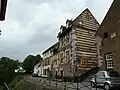 Op de Berg
- Maasberg and Op de Berg
 St Mary's Church
 St Augustine's Church
 Pump and chapel at Raadhuisstraat and Kaakstraat
References
- 1 2 3 "Kerncijfers wijken en buurten 2025" [Key figures for districts and neighbourhoods 2025] (in Dutch). Statistics Netherlands. 2026. regional codes BU09710100 and WK097101. Retrieved 15 August 2026.
- ↑ "Postcodetool for 6181AA". Actueel Hoogtebestand Nederland (in Dutch). Het Waterschapshuis. Archived from the original on 21 September 2013. Retrieved 26 April 2022.
- 1 2 3 4 5 6 "De ruimtelijke geschiedenis van Stein" [The spatial history of Stein] (PDF) (in Dutch). Municipality of Stein. 2018. pp. 45–47. Retrieved 15 August 2026.
- ↑ "De evolutie van renovatiewerkzaamheden aan stalen bruggen" [The development of renovation work on steel bridges]. Bruggen (in Dutch). Nederlandse Bruggenstichting. 2017. Retrieved 15 August 2026.
- ↑ "Bunder- en Elslooërbos" (in Dutch). Natura 2000. Retrieved 15 August 2026.
- ↑ "Bunder- en Elslooërbos" (in Dutch). Province of Limburg. Retrieved 15 August 2026.
- ↑ "Kasteelpark Elsloo" (in Dutch). Het Limburgs Landschap. Retrieved 15 August 2026.
- ↑ "Historie Botanische Tuin" [History of the botanical garden] (in Dutch). IVN Elsloo. Retrieved 15 August 2026.
- ↑ "Natura 2000-plan Bunder- en Elslooërbos – Hoofdrapport" [Natura 2000 management plan for Bunder- en Elslooërbos – main report] (PDF) (in Dutch). Province of Limburg. 2023. p. 101. Retrieved 15 August 2026.
- ↑ A. Porreij (2009). "100 bandkeramische huizen in Elsloo" [100 Linear Pottery houses in Elsloo] (in Dutch). DANS Data Station Archaeology. doi:10.17026/DANS-ZN5-M9K6. Retrieved 15 August 2026.
- ↑ "Pot met knobbeloortjes" [Pot with knob-shaped lugs] (in Dutch). Rijksmuseum van Oudheden. 2024. Retrieved 15 August 2026.
- ↑ "Elsloo-Koolweg Revisited: Science-based perspectives on the burials and grave goods of the Linear Bandkeramik burial ground of Elsloo-Koolweg". Cultural Heritage Agency of the Netherlands. 2022. Retrieved 15 August 2026.
- ↑ J. F. van Agt (1962). "Elsloo". Zuid-Limburg uitgezonderd Maastricht (in Dutch). Digital Library for Dutch Literature. Retrieved 15 August 2026.
- ↑ G. van Berkel; K. Samplonius (2018). "Elsloo – geografische naam" [Elsloo – geographical name]. Nederlandse plaatsnamen verklaard (in Dutch). Etymologiebank. Retrieved 15 August 2026.
- ↑ J. G. H. Notten (1972). "Orthographie en localisatie van plaatsnamen" [Orthography and localisation of place names]. Naamkunde (in Dutch). 4: 118–123. Retrieved 15 August 2026.
- ↑ Arnoud-Jan Bijsterveld (2015). "Machts- en territoriumvorming: van Karolingische kernregio tot territoriale lappendeken, 900–1200" [Formation of power and territory: from Carolingian core region to territorial patchwork, 900–1200]. In P. Tummers (ed.). Limburg. Een geschiedenis (in Dutch). Vol. 1. Maastricht: Limburgs Geschied- en Oudheidkundig Genootschap. p. 211. ISBN 9789081960229.
- 1 2 3 Sabine Broekhoven; Ronald Stenvert (2003). "Elsloo (gemeente Stein)". Monumenten in Nederland. Limburg (in Dutch). Waanders. Retrieved 15 August 2026.
- ↑ "Archeologisch speerpunt 'Verdronken kasteel' in Elsloo" [Underwater archaeology project ‘Drowned castle’ in Elsloo] (in Dutch). Historiehuis van de Maasvallei. 2 March 2023. Retrieved 15 August 2026.
- ↑ H. G. Weinberg (2019). 'Vrije Rijksheerlijkheden' in Limburg (1500–1800): deconstructie van een mythe ['Free imperial lordships' in Limburg (1500–1800): deconstructing a myth] (PDF) (PhD thesis) (in Dutch). Maastricht University. pp. 243–265. Retrieved 15 August 2026.
- ↑ "De Maasvallei in één oogopslag" [The Meuse valley at a glance] (in Dutch). Historiehuis van de Maasvallei. 2025. pp. 46–47. Retrieved 15 August 2026.
- ↑ "De gevolgen van de aanleg van het Julianakanaal voor het dorp Elsloo" [The consequences of constructing the Juliana Canal for Elsloo] (in Dutch). Historiehuis van de Maasvallei. 28 March 2025. Retrieved 15 August 2026.
- ↑ "Maaswerken: Maasroute" (in Dutch). Rijkswaterstaat. Retrieved 15 August 2026.
- ↑ "Elsloo in de Tweede Wereldoorlog" [Elsloo during the Second World War] (in Dutch). Historiehuis van de Maasvallei. Retrieved 18 August 2026.
- 1 2 3 "Kazemat Elsloo" [Elsloo casemate] (in Dutch). Visit Zuid-Limburg. Retrieved 18 August 2026.
- ↑ "Evader chart E0018 – Wellington L7802" (in Dutch). Studiegroep Luchtoorlog 1939–1945. Retrieved 18 August 2026.
- ↑ "Crash Site Vickers Wellington L7802". TracesOfWar. Retrieved 18 August 2026.
- ↑ "Elsloo in de Tweede Wereldoorlog" [Elsloo during the Second World War] (in Dutch). Historiehuis van de Maasvallei. Retrieved 18 August 2026.
- ↑ Ad van der Meer; Onno Boonstra (2006). Repertorium van Nederlandse gemeenten 1812–2006 [Repertory of Dutch municipalities, 1812–2006] (in Dutch). Royal Netherlands Academy of Arts and Sciences.
- ↑ "Historische buitenplaats Kasteel Elsloo" [Historic country estate Elsloo Castle] (in Dutch). Cultural Heritage Agency of the Netherlands. Retrieved 15 August 2026.
- ↑ "Herstel historisch theehuisje in Kasteelpark Elsloo" [Restoration of the historic tea pavilion in Elsloo Castle Park] (in Dutch). Het Limburgs Landschap. 22 January 2026. Retrieved 15 August 2026.
- ↑ "Kasteelmolen / Slakmolen te Elsloo" (in Dutch). Vereniging De Hollandsche Molen. Retrieved 15 August 2026.
- ↑ "Gezondheid en leefomgeving rond Chemelot" [Health and the living environment around Chemelot] (PDF) (in Dutch). National Institute for Public Health and the Environment. 2025. p. 43. Retrieved 15 August 2026.
- ↑ "Over het Maaslandcentrum" [About the Maaslandcentrum] (in Dutch). Maaslandcentrum Elsloo. Retrieved 15 August 2026.
- ↑ "Accommodatiebeleid gemeente Stein" [Facilities policy of the municipality of Stein] (PDF) (in Dutch). Municipality of Stein. 2019. p. 18. Retrieved 15 August 2026.
- ↑ "Stationsomgeving Beek-Elsloo gaat op de schop" [Beek–Elsloo station area to be redeveloped] (in Dutch). ProRail. 23 February 2024. Retrieved 15 August 2026.
- ↑ "Vernieuwde stationsomgeving Beek-Elsloo officieel geopend" [Renewed Beek–Elsloo station area officially opened] (in Dutch). Municipality of Beek. 30 June 2025. Retrieved 15 August 2026.
- ↑ H. Crompvoets (1988). "De beide Limburgen als dialectologisch slagveld" [The two Limburgs as a dialectological battlefield]. Woeringen en de oriëntatie van het Maasland (in Dutch). Digital Library for Dutch Literature. pp. 101–102. Retrieved 15 August 2026.
- ↑ Jo Cobben (2000). "De Platte Aelsenaer" (in Dutch). Historiehuis van de Maasvallei. Retrieved 15 August 2026.
- ↑ "Historie" [History] (in Dutch). Conincx Pop. Retrieved 15 August 2026.
- ↑ "Historiek – Elite Mannen" [History – elite men] (in Dutch). Amstel Gold Race. Retrieved 15 August 2026.
External links

- Elsloo.info – local news and history (in Dutch)
- Historiehuis van de Maasvallei – regional history museum (in Dutch)