Dhumakot
Dhumakot | |
|---|---|
Town and Tehsil | |
 Dhumakot Town in Nainidanda Block | |
  Dhumakot Location in Uttarakhand, India  Dhumakot Dhumakot (India) | |
| Coordinates: 29°45′11″N 79°00′36″E / 29.753°N 79.010°E | |
| Country |  India |
| State |  Uttarakhand |
| District | Pauri Garhwal |
| Elevation | 1,840 m (6,040 ft) |
| Languages | |
| • Official | Hindi[1] |
| • Native | Garhwali |
| Time zone | UTC+5:30 |
| PIN | 246275 |
| Vehicle registration | UK-12 |
| Website | pauri |
Dhumakot is a hill town and administrative tehsil located in the Pauri Garhwal district of the Indian state of Uttarakhand.[2] It is bordered by the tehsils of Lansdowne, Kotdwar, Thalisain and Bironkhal. It is also bordered by the districts Almora and Nainital of Kumaon.[3]
Etymology
The name Dhumakot (धूमाकोट) was derived from Dhuma Devi (धूमा देवी), a goddess worshipped in the area. A temple dedicated to Dhuma Devi is located in Dhumakot. The settlement was named after the goddess. The suffix "-kot" (कोट) is a common element in Himalayan place names and refers to a fort or fortified settlement. Thus, Dhumakot refers to the settlement or fort associated with Dhuma Devi.
Geography
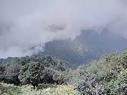
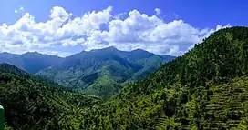
Located in the Pauri Garhwal district of Uttarakhand at approximately 29.87° N latitude and 78.74° E longitude. It lies in the middle Himalayan region, marked by hilly terrain, forests, and seasonal streams.The tehsil is divided into several revenue villages.


Climate
Dhumakot has a warm and moderate climate, strongly influenced by its elevation and Himalayan terrain. The climate is classified as Cwb (subtropical highland climate with dry winters) under the Köppen–Geiger system. The average annual temperature is approximately 15.7°C, with annual precipitation of about 1,837 mm. Rainfall is concentrated during the summer monsoon, with July being the wettest month, receiving around 547 mm of rainfall, while November is the driest, with about 7 mm. June is the warmest month, with an average temperature of about 21.7°C, while January is considerably cooler, with an average low of around 7.2°C. The combination of Dhumakot's elevation, mountainous topography and seasonal monsoon rainfall gives the area a distinctive cool-to-moderate Himalayan climate.[4]
| Dhumakot | ||||||||||||||||||||||||||||||||||||||||||||||||||||||||||||
|---|---|---|---|---|---|---|---|---|---|---|---|---|---|---|---|---|---|---|---|---|---|---|---|---|---|---|---|---|---|---|---|---|---|---|---|---|---|---|---|---|---|---|---|---|---|---|---|---|---|---|---|---|---|---|---|---|---|---|---|---|
| Climate chart (explanation) | ||||||||||||||||||||||||||||||||||||||||||||||||||||||||||||
| ||||||||||||||||||||||||||||||||||||||||||||||||||||||||||||
| ||||||||||||||||||||||||||||||||||||||||||||||||||||||||||||
| Climate data for Dhumakot (1991–2021) | |||||||||||||
|---|---|---|---|---|---|---|---|---|---|---|---|---|---|
| Month | Jan | Feb | Mar | Apr | May | Jun | Jul | Aug | Sep | Oct | Nov | Dec | Year |
| Mean daily maximum °C (°F) | 13.5 (56.3) |
15.6 (60.1) |
19.8 (67.6) |
24.6 (76.3) |
26.4 (79.5) |
26.1 (79.0) |
24.0 (75.2) |
23.6 (74.5) |
23.2 (73.8) |
21.3 (70.3) |
18.6 (65.5) |
15.6 (60.1) |
26.4 (79.5) |
| Daily mean °C (°F) | 7.2 (45.0) |
9.4 (48.9) |
13.4 (56.1) |
18.1 (64.6) |
20.6 (69.1) |
21.7 (71.1) |
21.0 (69.8) |
20.6 (69.1) |
19.3 (66.7) |
15.8 (60.4) |
12.3 (54.1) |
8.9 (48.0) |
15.7 (60.2) |
| Mean daily minimum °C (°F) | 1.6 (34.9) |
3.5 (38.3) |
6.8 (44.2) |
11.2 (52.2) |
14.5 (58.1) |
17.2 (63.0) |
18.7 (65.7) |
18.3 (64.9) |
16.0 (60.8) |
10.8 (51.4) |
6.7 (44.1) |
3.2 (37.8) |
10.7 (51.3) |
| Average rainfall mm (inches) | 38 (1.5) |
62 (2.4) |
46 (1.8) |
43 (1.7) |
80 (3.1) |
228 (9.0) |
547 (21.5) |
499 (19.6) |
235 (9.3) |
35 (1.4) |
7 (0.3) |
17 (0.7) |
1,837 (72.3) |
| Average rainy days | 4 | 6 | 6 | 6 | 10 | 15 | 21 | 21 | 17 | 6 | 1 | 2 | 115 |
| Average relative humidity (%) | 73 | 67 | 56 | 44 | 51 | 67 | 88 | 89 | 85 | 73 | 69 | 71 | 68 |
| Source: Climate-Data.org[5] | |||||||||||||
Data periods: 1991–2021 for minimum and maximum temperature, precipitation, humidity and rainy days; 1999–2019 for average sunshine hours.[5]
Historical Place
Gujrugarhi - Located in the Nainidanda region of Pauri Garhwal, Gujrugarhi is a historic site associated with Gujru Fort, traditionally counted among the 52 forts of the Garhwal region. The site contains an old temple and caves, and its strategic location is associated with the history of the Garhwal kingdom and the period of the Gorkha invasions. Gujrugarhi is approximately 20 km from Dhumakot and is reached by a trek from Kingorikhal.[6]

Deeba Devi Temple, also known as Deeba Temple, is a Hindu temple located in the Patti Khatli area of Pauri Garhwal district, Uttarakhand, India. The temple is dedicated to Deeba Devi, who is regarded in local tradition as a guardian deity of the surrounding region. Local oral traditions associate the shrine with the period of Gorkha expansion into Garhwal and credit the goddess with protecting the local population.[7] The temple stands on an elevated ridge known as Deeba Danda and is noted locally for its panoramic views of the surrounding hills. Several legends and religious traditions are associated with the shrine, including stories concerning a cave beneath the temple and the goddess's role in protecting people during the Gorkha period.

Politics
Previously, it was an assembly constituency[8] but the seat was abolished in 2012 after delimitation. The area is now part of Lansdowne seat and in Lok Sabha it is part of Garhwal seat.[9] Former Uttarakhand Chief minister B.C. Khanduri represented the Dhumakot constituency and later served as Chief Minister from September 2011 to March 2012.[10]
Demographics
According to the 2011 Census of India, Dhumakot tehsil in Pauri Garhwal district had a population of 39,230 people, distributed across 331 villages. The population is predominantly rural, with settlement scattered across the mountainous terrain of the Garhwal Himalayas.[11]
Economy
The economy of Dhumakot is largely dependent on agriculture, with rice, and wheat being the main crops. The tehsil is also home to a number of small-scale industries, including handlooms, handicrafts, and forestry. There is a Government Degree College in the area.[12]
References
- ↑ "Hindi".
- ↑ "Tehsil | District Pauri Garhwal, Government of Uttarakhand | India". Pauri.nic.in. 27 December 2022. Retrieved 31 December 2022.
- ↑ "Pauri Garhwal Map". 22 November 2019.
- ↑ https://en.climate-data.org/asia/india/uttarakhand/dhumakot-275989/
- 1 2 "Dhumakot climate: Weather, temperature and climate data". Climate-Data.org. Retrieved 5 August 2026.
- ↑ https://www.sacredyatra.com/gujru-garhi-temple.html
- ↑ https://kahanisunao.com/deeba/
- ↑ "Dhumakot Bye-Election: Chief Electoral Officer, Uttarakhand, India". Ceo.uk.gov.in. 29 April 2011. Retrieved 31 December 2022.
- ↑ "Uttarakhand Electoral Roll 2020(?)" (PDF) (in Hindi). Chief Electoral Office. Archived from the original (PDF) on 25 December 2022.
- ↑ https://www.ndtv.com/india-news/uttarakhand-bc-khanduri-sworn-in-as-chief-minister-467317
- ↑ https://villageinfo.org/sub-district/dhoomakot
- ↑ "Government Degree College Nainidanda, Pauri Garhwal, Uttarkhand". gdcnainidanda.ac.in.