Bobcat Pass
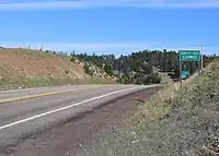
Bobcat Pass is a mountain pass located in Taos and Colfax counties on the Enchanted Circle Scenic Byway in New Mexico, U.S.[1]
Geography
At 9,836 feet (2,998 meters) in elevation, it is the highest mountain pass in New Mexico.[2][1][3] It is located on NM 38 between Eagle Nest, New Mexico[4] and Red River[3] on the boundary of the Carson National Forest.[1] The pass is the head of the Bobcat Creek, named for the frequency of the bobcat in the area.[5]
Description
Wildlife in the area include elk, which may be seen about 6 in the evening.[6] Cross-country skiing and snowshoeing are available at the summit of the pass.[7]
References
- 1 2 3 United States. Forest Service. Southwestern Region (1990). Enchanted Circle and Valle Vidal Loop tours: Carson National Forest. U.S. Dept. of Agriculture. p. 9.
- ↑ "Bobcat Pass". Geographic Names Information System. United States Geological Survey, United States Department of the Interior. November 13, 1980. Retrieved June 15, 2026.
- 1 2 Laurence Parent (11 January 2011). Scenic Driving New Mexico, 3rd. Globe Pequot. p. 10. ISBN 978-0-7627-6762-5.
- ↑ Fodor's Travel Publications, Inc. Staff (2011). Fodor's New Mexico. Fodor's Travel Publications. p. 243. ISBN 978-1-4000-0530-7.
- ↑ Robert Hixson Julyan (1 January 1996). The Place Names of New Mexico. UNM Press. p. 44. ISBN 978-0-8263-1689-9.
- ↑ Sharon Niederman (5 March 2012). Signs & Shrines: Spiritual Journeys Across New Mexico. Countryman Press. p. 233. ISBN 978-0-88150-908-3.
- ↑ Sharon Niederman (5 March 2012). Signs & Shrines: Spiritual Journeys Across New Mexico. Countryman Press. p. 97. ISBN 978-0-88150-908-3.